Author: Lisa
Professional photographer. Ambassador for Pierce County, Washington Trails Association. Retired elementary school teacher.
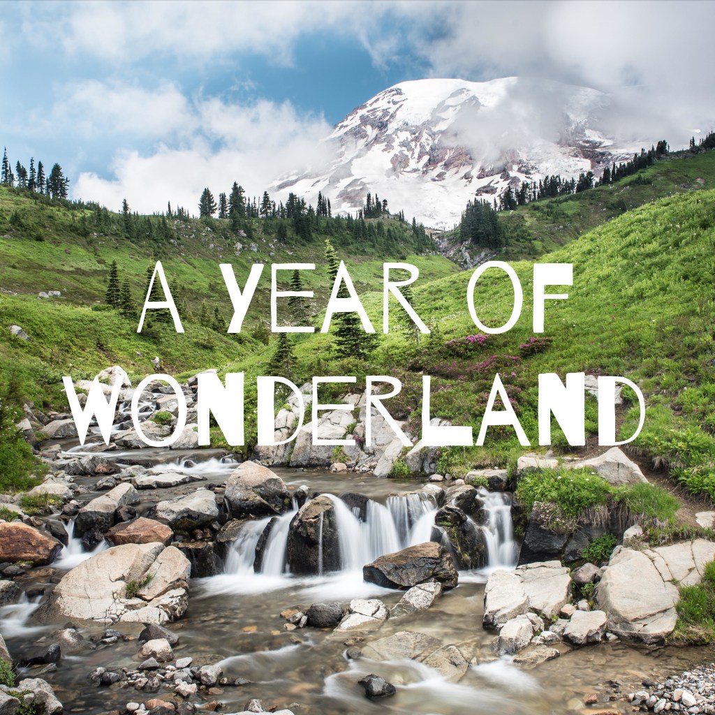
Mt. Rainier Wonderland Trail Permits 2021
The permit system has changed again this year. New for 2021 is the permit system through Recreation.gov.
This is the timeline for three opportunities to get a permit for 2021.

The Spirit of Adventure 1843
Are you heading west to the Pacific Northwest? Perhaps you’d like to take in the mountain scenery, go for a hike or backpack in several of our National Parks.
The white mans history of the Pacific Northwest isn’t a long one.
When I think back to how early pioneers and Native Americans lived in the Pacific Northwest, it is the spirit of adventure that comes first to mind.

Mortal Arrow Wound to the Head
What should have been a mortal wound that ended his life, Nathan headed west having an arrow tip from a battle that permanently pierced into his frontal lobe. Discovering our ancestor, Nathan Olney, 1824-1866, was a pivotal find my mom first learned of during one of her many genealogy digs.
Nathan Olney was our great-great uncle, who came to live in Washington through the Dalles, Oregon. He journeyed west on the Palmer and Barlow wagon train arriving in the Willamette Valley, Oregon during 1843. In 1847 he will later become known as the first settler and resident of The Dalles known as Wascopum a small village.

First Resident, Judge, Commissioner, Sheriff, Indian Agent
If it wasn’t perilous trying to get here, the otherwise peaceful Indians who moved and lived around early explorers and fur traders easily, where unsure of the new arrival of permanent families, cattle, wagons and living on the land.
Through this one simple genealogy find, my mom soon connected with a cousin, and direct descendent of Nathan, Teresa Anahuy. Teresa filled in the history she knew. Holes and pieces that were missing slowly filled around Nathan’s life and time spent coming to the Northwest, eventually to Ft. Simcoe on the Yakama Indian Reservation in Washington where he later married and lived out his short life.
Nathan eventually married Teresa’s grandmother, Annette, who was the daughter of a Yakama chief.
As a 19 year old, Nathan originally made his home in The Dalles. Over the next few years he was a merchant providing supplies and food to pioneers expanding their way west. The journey west was a perilous one for pioneers who traveled by wagon and foot towards a better life in the great northwest where they would eventually ford the Colombia River into what is now Washington State.
The following document from a speech given at Nathan’s gravesite by Dr. Thomas Griffith, August 12, 1956 when a bronze plaque was provided and “placed upon his monument in memory of a fine Gentleman of the Pioneer days who passed from this life in the prime of manhood.”
Dedication Speech for Nathan Olney’s Memorial Plaque
by Dr. Thomas Griffith
“Immediately after the news of the Whitman Massacre reached the western settlements, Nathan Olney recruited and commanded a company of scouts, served with distinction under Colonel Gilliam during the Cayouse Indian War.
After the Territorial Government was formed in 1849, Wasco County was created. Included within its boundaries was a vast area of land extending from the summit of the Cascade mountain range in the west to the peaks of the Rocky Mountains in the east. In this, the largest County in the Territorial Government a that times, Nathan Olney served successfully in its administration as County Judge, Commissioner, Sheriff, and later during 1862, when Oregon had achieved Statehood, he became Ex-Officio Probate Judge.
In the early records of Wasco County he is referred to as “The Honorable Nathan Olney.”
During periods of time between 1854 and 1859, in addition to his many other duties and services, he served as Sub Indian Agent at Ft. Simcoe on the Yakama Reservation.
He rendered valuable assistance to Father Wilbur, one of the outstanding conscientious Agents, in the formative period of the Yakima Indian Agency.
He, Nathan Olney, was Father Wilbur’s friend.
In 1855, while Fort Dalles was garrisoned by troops from the Fourth and Ninth Infantry Regiments together with detachments from Artillery Units and Dragoons, a meeting was held by the citizens of the towns to formulate Articles for a local government and for the divisions of properties. Nathan Olney assisted in the preparation of these Articles which were approved by the Territorial Legislature during the 1855-1856 Session.
It goes without saying Nathan was well liked by the Yakama people. So well liked, he is the only white man who is buried on native land that we know of. There is a large headstone at his place of rest as proof.
Nathan died the same way he arrived. At 42 years of age, a fall from a horse and he hit his head pushing the arrow head farther into his skull.
Nathan Olney, 1824-1866


Puyallup, Klapatche, and the few Native Languages on The Wonderland Trail
The following is a prelude to Video Episode 12 you can either click here to watch the video or read through and click at the end.
Chapter 17 Synopsis: Some of the most spectacular scenery met with some of the hottest and strenuous conditions, Lisa and Sandy find themselves pushed to their physical limits and under a time crunch to get to make it to South Puyallup Camp before nightfall.
Learning the Native Language of Town Names
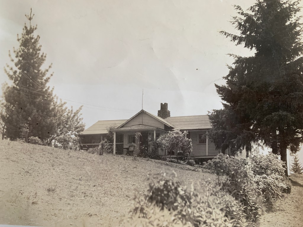
My hometown is Puyallup, pronounced Pew-all-up. Generations of my family have lived here since the early 1900’s.
Arriving from Buffalo, New York, my great-great grandparents purchased 10 acres of land in the Fruitland area of So Hill. A cable car conveniently ran from downtown Tacoma through the outskirts and then past our farm and then continued down Fruitland Avenue to Puyallup.
Our farm was one of the only farms that had a spring year around on the hillside. My grandmother said many people would stop at the spring, which was small, to get water. As a kid growing up this small 5′ in diameter hole created hours fun as I remember sinking my feet in the thick, gooey mud and searching for small amphibians. Somewhat hidden and tucked away in the old growth woods, my grandparents and great-grandparents had arranged small rocks around the border of the front where one could rest a hand as they kneeled and stooped forward.
The back side of the spring had a tall bank, where small ferns and roots would stick out. A small trickle of water added to the landscape where I imagined make believe friends and fairies.
Growing up here was magical. The back 7 acres consisted of a water pipeline and road that carried water from the McMillan Reservoir to the City of Tacoma. Beyond that was nothing but trees. Tall, deep, old trees with a wide deep trail, eight city blocks long that connected 104th st to 112th St.


Along with the early stories of my grandmother and uncles traveling to Longmire, a two day trip before good roads, this is where my love of nature and the natural surroundings transpired.
My grandmother and I would take daily walks through here. By the time I was in second grade I knew most of the names of the small plants and types of trees the forest held. We would be pick wild strawberries, tiny and sweet from the borders of the thick woods. Red Huckleberries would poke their shrubby heads up out of stumps that would make a yummy small pie. And always the grand finale of the walk was to go up to the top of the pipeline road to see if the mountain was out.
My parents and brothers and sister and I lived next door until the late 60’s. My grandparents lived here until the 70’s, then my husband I did until the 80’s. My great-uncle, my grandmother, my mother, my dad, my self, my brothers and sister, my niece, nephew, cousins, and now my grandchildren either all graduated from Puyallup High School or currently attend Puyallup schools. Many of us still live in the area but nothing but the spring and the old house sitting alone my grandparents lived in still remain.
Puyallup has changed into freeways and strip malls like most of urban-housed, grange-fed America.
Climbing Trees and Mountain Trails
Thinking back another great pass time of mine was climbing evergreen trees. There were a few favorites of mine, a cedar in our side yard between my parents and grand-parents house and a fir at the front edge of our property even thought there were many others to choose from.
The cedar’s branches were always coated in a fine green dust and pointed down, probably because the limbs were abundant and rarely disrupted. It was those limbs that saved my life once as I slipped, lost my grip and fell about 30 feet once. Hitting each limb, broke my fall and I ended walking away with just the air knocked out of me.
The fir was another story. My dad cut the limbs off the bottom so I could not reach the branches to climb. A portable step made out of a tree trunk was a local find in the gully and I easily rolled it to position. The tree climb was easy here up sixty to eighty feet. Even better was a windy day when you swayed with the top of the tree and could see all your neighbor’s yards front and back within the same block.
Day 12
Golden Lakes, Klapatche Park to South Puyallup Camp

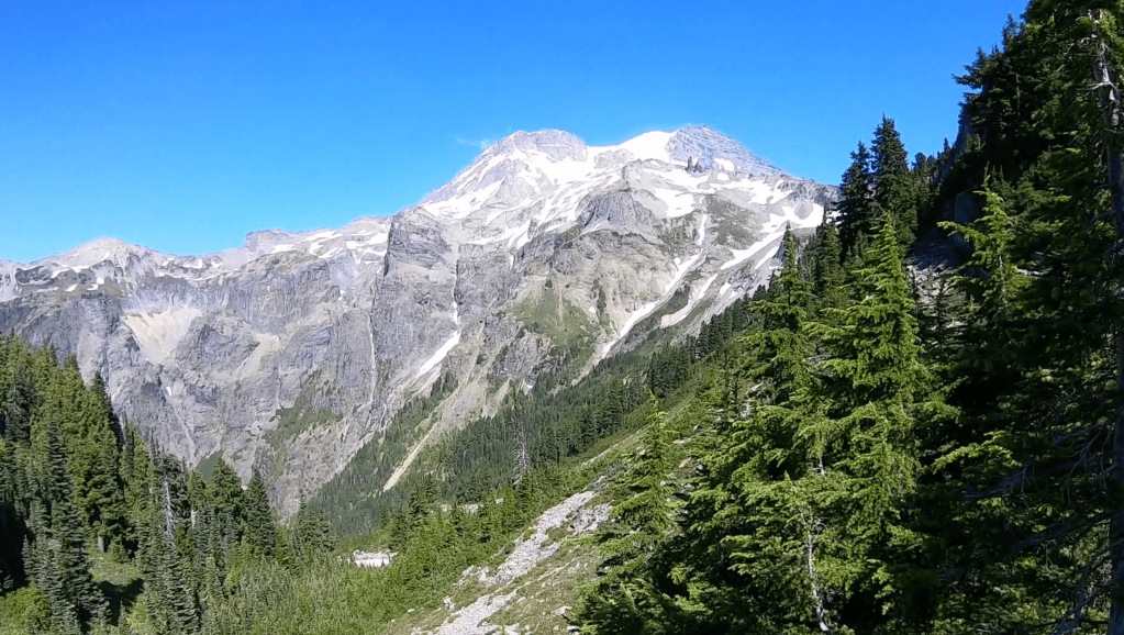
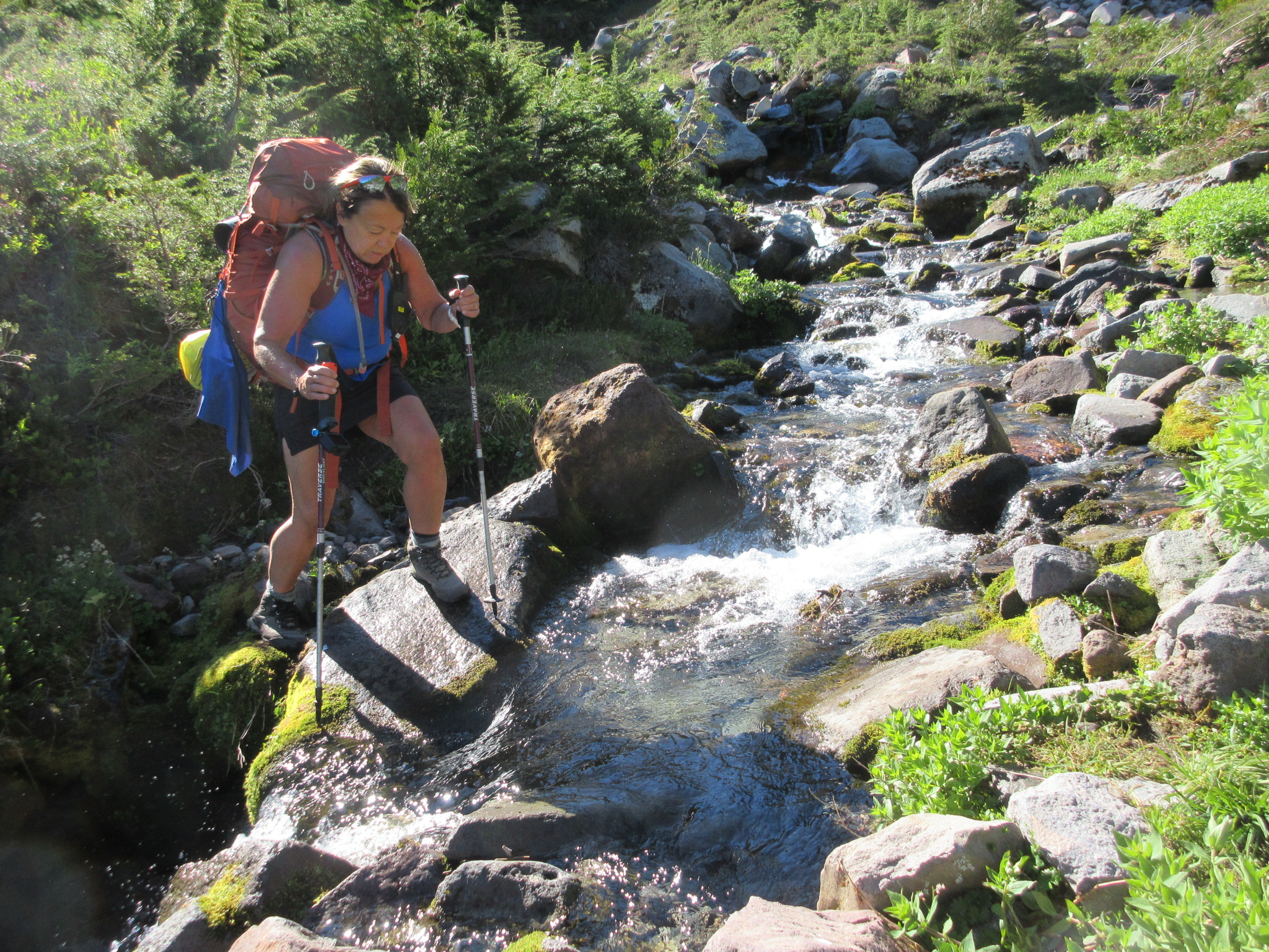
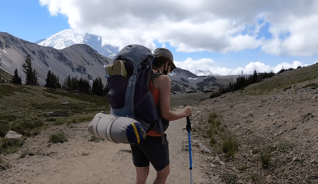
A willingness to endure some discomfort is the type of passion it takes for this stretch of the Wonderland. With August temperatures nearing ninety degrees, Sandy and I made our way from Golden Lakes through Sunset Park to the South Puyallup Camp.
Approaching some of the most beautiful scenery imaginable we stopped for a snack at the very end of the Westside Road before heading up to Klapatche Park. Now closed at mile two, Westside road was grand memory of times when we used to drive it to day hike in high school.
This is when the heat started and Sandy’s blisters from her new boots became worse. Hiking up the hill in the heat, we approached Aurora Lake and we decided to stick our feet in and have lunch. It made for a nice spot because our friends from Golden Lakes were camping at Klapatche and the four women were no where in site.
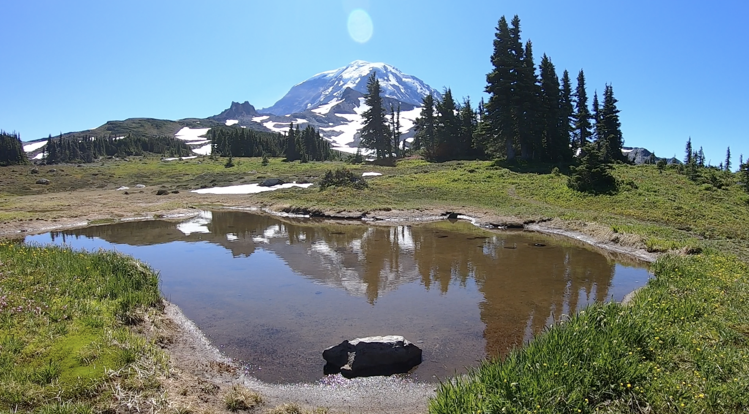
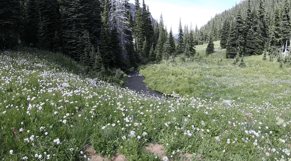
The three of us walked around through the lake, cooling off and lunching with the lake lapping up the reflection of Mt. Rainier. Klaptache Park is the place to stay.
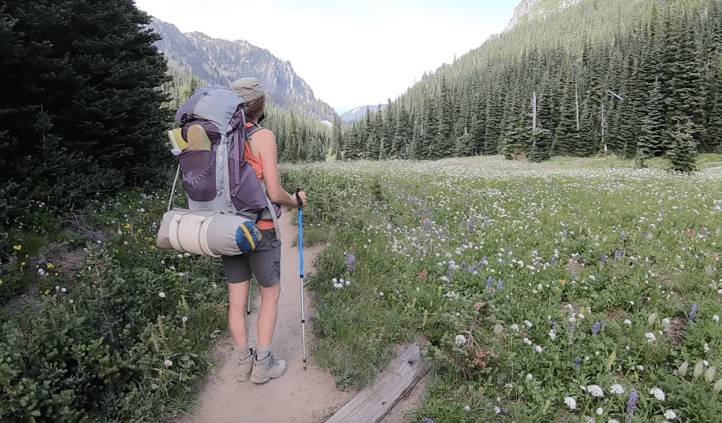
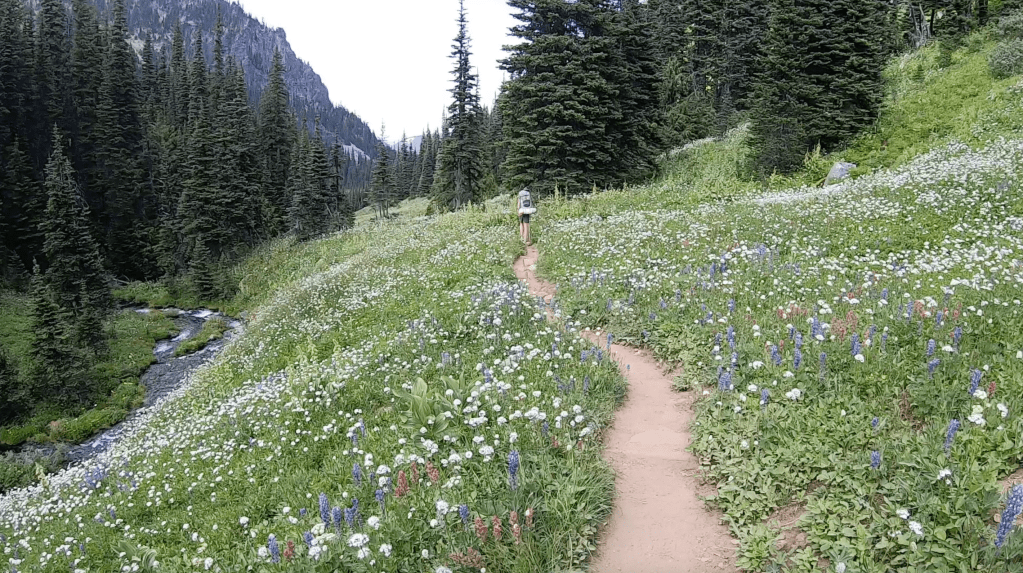
Making our to St. Andrews Lake, we break at the top in the heat of the day. I will never forget this being one if not the most beautiful spots on the trip, the exhilaration of the view and colorful and explicit language of our feelings of being completely done.
With weight of heavy backpacks, the heat, and uncomfortable footwear we continued unbroken but spent as we gently stepped our way down a long forgiving trail to South Puyallup Camp.
To live here you know the native names Puyallup- Pew-all-up, Tacoma- Ta-co-ma, Enumclaw-Eee-numb-claw, Sequim-Sqim, Snoqualmie- Snow-qual-me, Olympia- O-limp-pia, Mowich-Mau-ich, Klapatche- Kla-patch-ee, and the real name of Mt. Rainier, Tahoma- Ta-ho-ma

Video Episode 12 click here to watch the video.
Backpacking Mt. Rainier ~ 14 Days
CHAPTER 15~ MOWICH LAKE
The following is a prelude to Video Episode 10 you can either click here to watch the video or read through and click at the end.
Video Synopsis: Taking you high across snow fields to the beauty of Spray Park. Lisa says goodbye to Shannon with a backpack boogie send off. Runtime 9:04
My first experience with Mowich Lake happened when I was about 18. When you’re 18 you do just about anything.

Mowich Lake in the 1970’s
Living so close to Mt. Rainier, we frequently would camp up at Ipsut Campgrounds. Back then you could simply drive your car into a camp spot and just spend a night or two. The ranger would be around in the evening to collect payment for the spot usually sometime around evening supper.
Back 45 years ago we had rustic equipment. An old nylon tent that leaked was always accompanied by a blue tarp to over hang in the trees so it didn’t get too damp. At each corner of the tarp you would place a rock and gather the ends of the tarp forming a ball so you can wrap your cord around it then hoist it to a tree. Our Coleman camp stove had to have a few pumps to pressurize the tank and then there was our Thermos brand ice chest that kept things cool for most of a day.
Keeping things simple, the main thing I remember is collecting our own wood to keep warm, which is taboo now, then trying to light wet wood and twigs that steamed because they were so soggy. With little control of the environment we would wake up to cascading water inside the tent mixed with pine needles, an unsettling alarm to get up to. I was always cold.
The experience I remember most hiking on the Wonderland up from Ipsut Campground was a very steep climb that lead to Ipsut Pass. From there you follow the ridge about 1/2 mile leading to Mowich Lake.
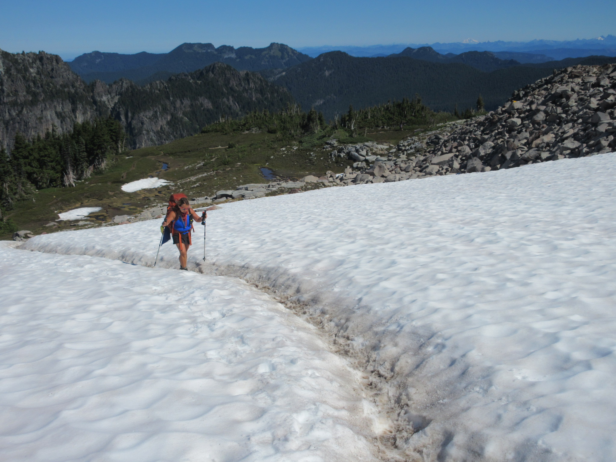
That early summer we decided to take on the 2800′ elevation gain early in the morning before heat caught up with us.
This trail starts out lovely and passes Ipsut Falls then takes a sudden sharp uphill grade full of switchbacks through the forest. What kept me going this particular day was the thought of this beautiful blue pristine alpine lake glistening in the sun above. I was reeling and ready with my swimsuit bikini top under my halter top. With an extra pair of jean cutoffs in my bag, I couldn’t see bringing a towel because I was just going to bask on the banks until I dried out in the middle of a secluded paradise.
My thought was I might even just take my clothes off all together, and take a little dip, no one would be there.
The first few miles we made our way easy enough. No one owned trekking poles back then. My hiking boots were tough girdled leather uppers with stiff hard soles. By the time we made it to a clearing where the pass began, we knew the last 1/2 mile would either condition us or kill us straight up to the sky.
What stood before us was giant boulders and loose rock that we ended up climbing on all fours to make our way. It was a scramble. No longer did the trees shelter us from the heat of the day that already lapped at our heals. Needless to say it was tough going and slower than we had predicted.
When we made it to the saddle we celebrated our accomplishment and walked our way along the ridge to Mowich seeing the remainder of a beautiful hot day and glistening lake ahead in our minds eye.
As we caught our breath our conversations started again. In the distance only sounds if faint breezes swayed trees above and low humming noise coming from very far off in the distance. As we continued, the faint noises became slightly louder in a low rumbling tone.
That sound was the sound of cars. A complete caravan of cars headed to Mowich Lake in the dust and music that trailed behind them.
At that point I remember falling to my knees and crying out, “I could have driven the car here!” Dust and people accompanied each and every car. Cars piled up in the parking lot, jockeying for positions, people chewing dirt but still smiling to be outdoors in a party of serenity.
My souvenir was not being able to sit for a week after that hike and there was the continual moaning that went along each time I squared down, “I could have drove, ohhhh,”
The road below to Ipsut Campground is closed and now the only was into the campground is on bike or foot.
And for the really brave person, you can drive the 11 miles of chuck holes if you dare.
Just remember your towel and some repair tools if your car disagrees with your decision and preemptively revolts.
Cataract Valley Campground, Seattle Park, Spray Park and Mowich
After the Big W our camp for the evening was at Cataract Valley. Shannon reminded me she had stayed here before in her earlier trip around The Wonderland and it was one of her least favorite camps mostly because of the fog they had encountered.
At the time we rolled in late in the afternoon, we began our search for we thought would be the best spot. The first two sites, unoccupied, looked like they had just melted out of snow and appeared damp. As we grew closer to the creek, we found an ideal spot next to water, the bear pole and a happy couple just across the way.
We pitched our tents and I hardly remember dinner that night and fell asleep early putting away the long day. Day 10 had been a rough one.
Morning sunrise breaks around at 6 am in August in the Pacific Northwest and like clockwork we were up having our breakfast and gathering our tents up. The reality of this being the last day for Shannon was setting in on her.
Our last day would include over Seattle Park, to Spray Park and then our final day at Mowich.

Seattle Park
DAY 10
Day 10 to Seattle Park we come across more downhill assisted trail runners. As we attempt to merge to one spot it’s impossible. The trail is so narrow and only a deep rut uphill. Shannon and I step off and stop to avoid doing trail damage. At this point we know if we don’t the runner will step off and then run down the sides of the trail trampling the little plants that have taken a half century to get to the size of a peanut.
At this spot at tree line, the trees start to look like they are growing sideways because of the snow and wind they carry with them as they stretch toward the sun. It truly was one of my most favorite areas so far. The mountain in the background, creeks babbling and cascading, a few rock challenges, snow,

The snow at Seattle Park still exits in August and the insects appear so excited for the opera of spring to begin, they want to carry us off in their ecstasy. At the rocky outcropping painted orange as a monument to Seattle Park we see backcountry skiers heading to glacier ski probably around Flett Glacier and just below Observation Rock. This the glacier the professor my grandmother admired so well was named for. At this point a few day hikers emerge from the opposite direction telling us of a mama bear and cubs just over the next hill.
We’ve grown accustomed to seeing bears but ask for exactly what was seen, eyes on, not just someone said they saw a bear and decided to pass information on.
Happy but sad, my last day with Shannon.
Spray Park
Along our way we are bear aware but mostly we see day hikers at mid day traveling from Mowich Lake. We start to get a lot of questions at this point. Where have we been, how long have we been out here, etc. Our big backpacks are tell tale of our adventure. I notice other tell tale signs, like white lines at the crease at inside of my elbows due to grasping poles and an uneven tan line and my legs look chiseled and sinewy.
The original Wonderland Trail would have not taken us through Spray Park but instead down to Ipsut Campground and back up the Ipsut Pass to Mowich. Many “Wonderlanders” now choose the Spray Park alternate.
The last time Shannon was there it was foggy and that is what many encounter here but I have been here enough times day hiking to know the beauty of a blue bird day.
I hope her last day was her best.


The Backpack Boogie
The Backpack Boogie Video Episode 10
Dehydrated Mushroom Stroganoff
Backpacker’s Mushroom Stroganoff
Modified recipe from Susan Seutter


This recipe is absolutely delicious and super easy to make and rehydrate.
1 Whole Onion Diced
2 Cups Sliced Mushrooms
2 Garlic Cloves
2 Cups Spinach
1 Tbsp Worcestershire Sauce
1 tsp. Hot Hawaiian Sea Salt
3 Tbsp flour
1 Can Coconut Milk (save out 3/4 C for flour mix)
2 Whole Bay Leaves
1 tsp. Pepper
1 Scoop plant based Protein Powder Vanilla Organic
Add onion and garlic to pan, on medium heat, saute’ until onion is clear and caramelized.
Add approximately half the can of coconut milk, mushrooms, spinach, and seasonings. Stir until well combined over low heat.
In separate bowl add remaining coconut milk and flour, shake or whisk.
Turn up heat to a simmer and add flour mixture stirring until stroganoff thickens.
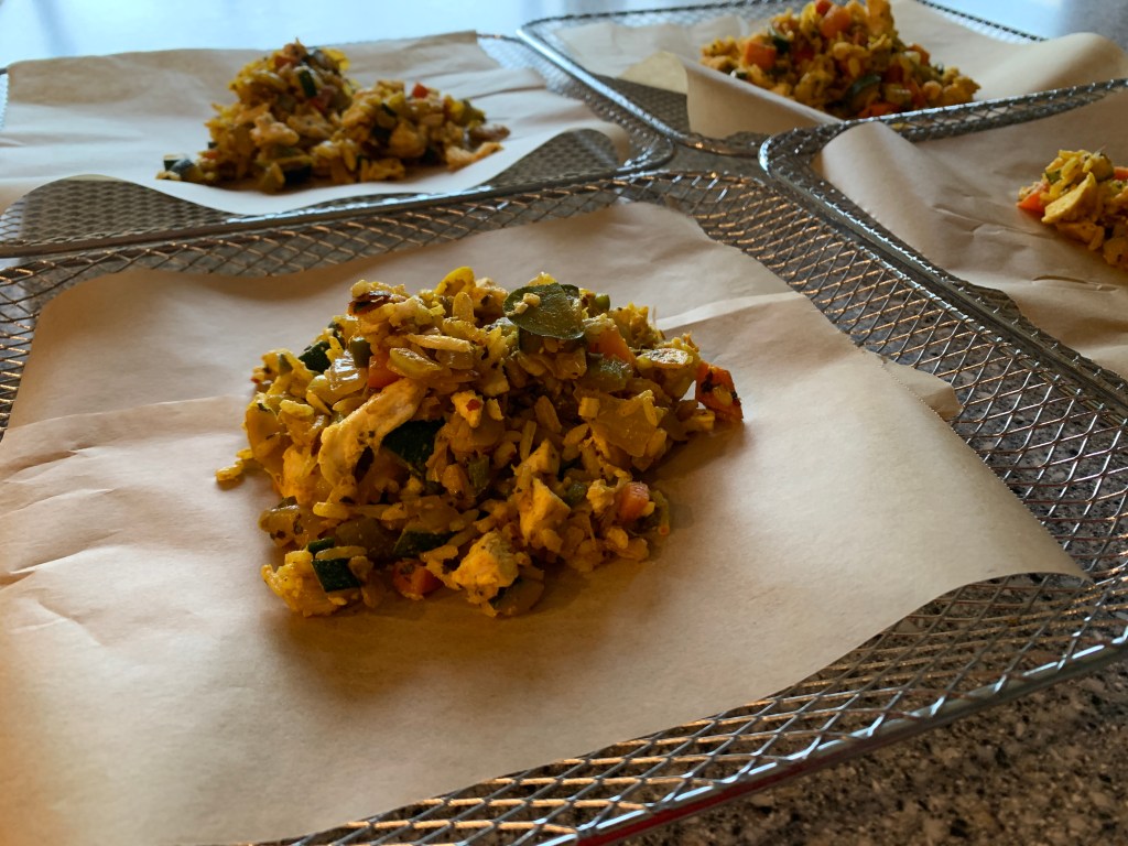
To Dehydrate:
Using parchment paper. Scoop out stroganoff until about 1/4 thick on racks. It might take 4-5 racks.
Dehydrate for 8 hrs, rotating racks and breaking pieces into smaller chunks.
Dehydrate until the chunks are uniform and crumbly.
Place each try in one ziplock freezer bag and freeze.
To Rehydrate:
Boil water, add 1/2 C to each ziplock, seal and place in bowl. Add more water for desired consistency.
We serve over Idahoan dehydrated potatoes.
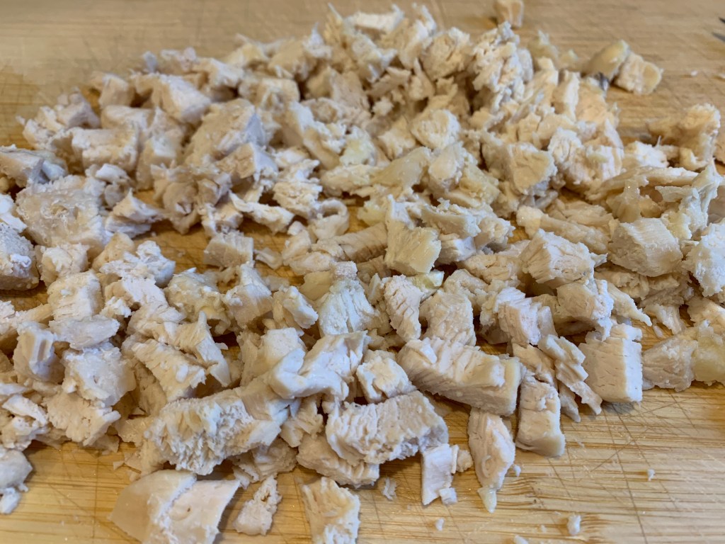
Dehydrated Chicken and Rice Curry Recipe
I look for recipes that can easily be chopped into equivalent sizes for dehydrating. I added diced and cooked chicken breast after making the main recipe then dehydrated the regular way by rotating racks and breaking the meal into small pieces. It took a bit less time than the 8 hours shown. After the dehydration process, I placed the separate racks into one zip lock bag and put them all in the freezer for storage.


Far Into The Northern Loop Trail

The following is a prelude to Episode 9 Video. You can click and watch here or read and click the link at the bottom.
Video Synopsis: Episode 9 finds Lisa and Shannon covering the most mileage of the entire trip with over 6600′ vertical gain and 6600′ vertical loss. Lisa finds trail miles are a lot longer than regular miles as she pushes across the Carbon River Suspension Bridge with still another uphill climb with epic scenery hardly ever viewed. Runtime 12:25
The Big W– Where the Boots Meet the Trail
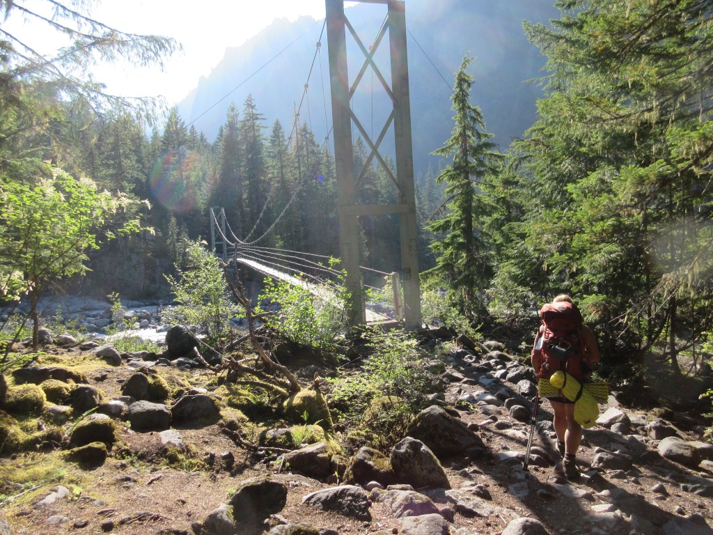
We plan to leave early, breaking down camp before breakfast around 6 am. The decision last night was to get to bed early, put a few miles behind us and to cross a sketchy river crossing at the West Fork of the White River in order to enjoy breakfast stretched out in the early sunshine.
Shannon titled this day the BIG W due to the elevation loss, gain, loss and then gain again. Her title made it simply understandable of the amount of miles ahead of us this day.
Planning ahead, if the miles wouldn’t challenge us enough, the West Fork of the White River crossing known to be hazardous, and the elevation gain and loss certainly could. Reports of years of downed timber and limbs and blow downs strewn everywhere, we wanted to put this section behind us early. Recent reports had been good that the foot bridges were in place and stable so our positive outlook remained optimistic.
Remote and seldom maintained by the park due to limited access to get trucks or machines to the area, rangers and crews on foot carry chainsaws and hand tools to do the work Mother Nature and her forces push at them each winter. I remember seeing a trail on a map that continues down the east side of the West Fork of the White River. Just as we start heading west to cross the map showed further north leading to the boundary and possibly a forest service road that is used to maintain the trail crossing.
Other than that, this portion of the Northern Loop is an often overlooked by backpackers as a must do. Most prefer to go on The Wonderland running inside and closer to the mountain.

Early Morning Hike to the West Fork of the White River
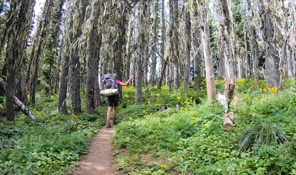
Along the southern ridge we could see the deep valley below with the West Fork of the White River. We survey the river towards then up towards the mountain leading to the Winthrop Glacier. The forest floor exploding full of bright green foliage and yellow wildflowers. Around the corner of the ridge, the trail now down switches back and forth and back and forth and back and forth with long easy switchbacks lasting miles.
This forested section appears very dry comparatively to the other lush areas of the wet landscape of Rainier. The dropped needles on our path look dry and hardy. There were minimal trickles and creeks spilling across the trail, which made the trail a gradual slopped descent to the river. The trees still towering above were smaller in size and meek in girth. We saw no one as The Northern Loop is very much isolated as predicted compared to The Wonderland Trail.

Hearing the river below as we near the crossing, then seeing it before us, helped push our mental state through the delta of silt. This hard to find trail has been diverted several times over the years and it could take some bushwhacking and common sense. My thoughts were how difficult the navigation must be in the snow early season or depending on the time of day or the time of year.
When we see the sign to the crossing, indeed showing there is a way to continue north to the park boundary, we have already started picking huckleberries and eating them. We imagine fairy gardens on logs and are entertained by the mushrooms and moss that could be hiding little people.


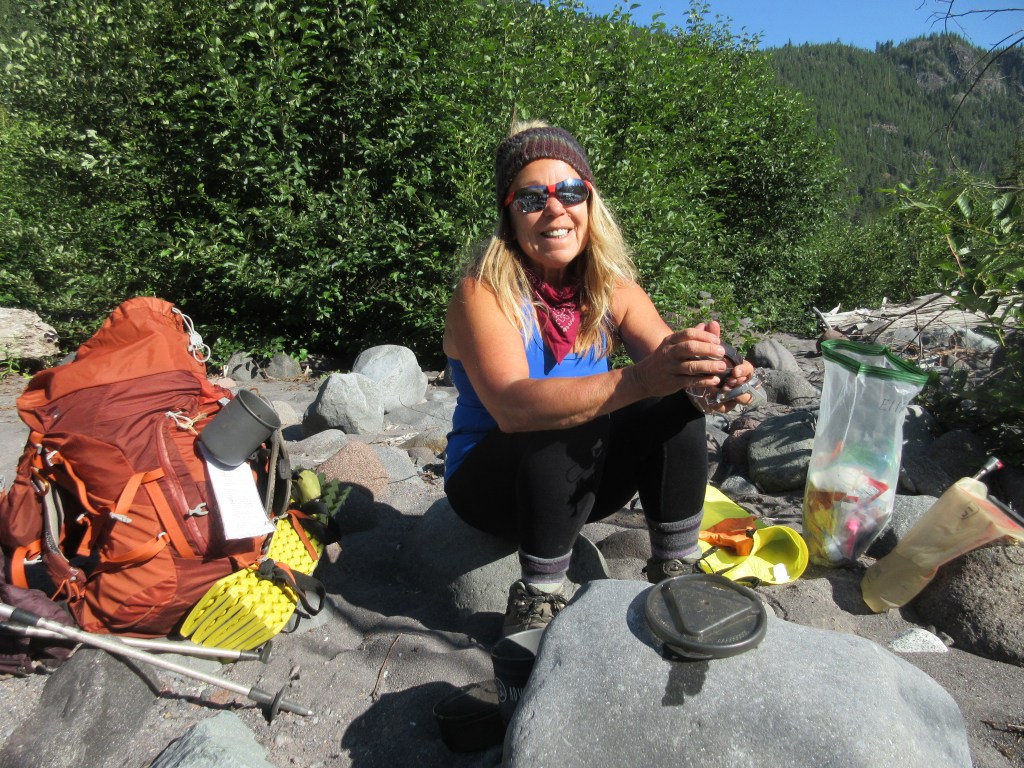
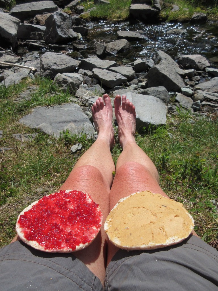
Breakfast at the West Side of the West Fork of the White River
I’m sure Shannon would agree this one of the nicer places to have breakfast. We pull out our stoves, take off our packs, boots, coats, and bask and enjoy our little outside diner complete with fairy gardens, water features and the sights and sounds of the morning.
Van Horn Creek and Falls
At Van Horn Falls we come across two men who appear dressed in street clothes. They seem as startled as we do. After seeing no one for hours, imagine coming across two younger men out in the middle of no where. We stop to filter water and a brief hello to survey the falls.

A Mountain to Climb
Still continuing on The Norther Loop Trail, we begin the steep ascent next to Redstone Peak, a mountain range to the north and slightly west of Rainier. Beyond will be Lake James, Lake James Camp then a range with jagged mountain peaks with names like Sluskin of Native American legend, dotted with lakes.
Lake James
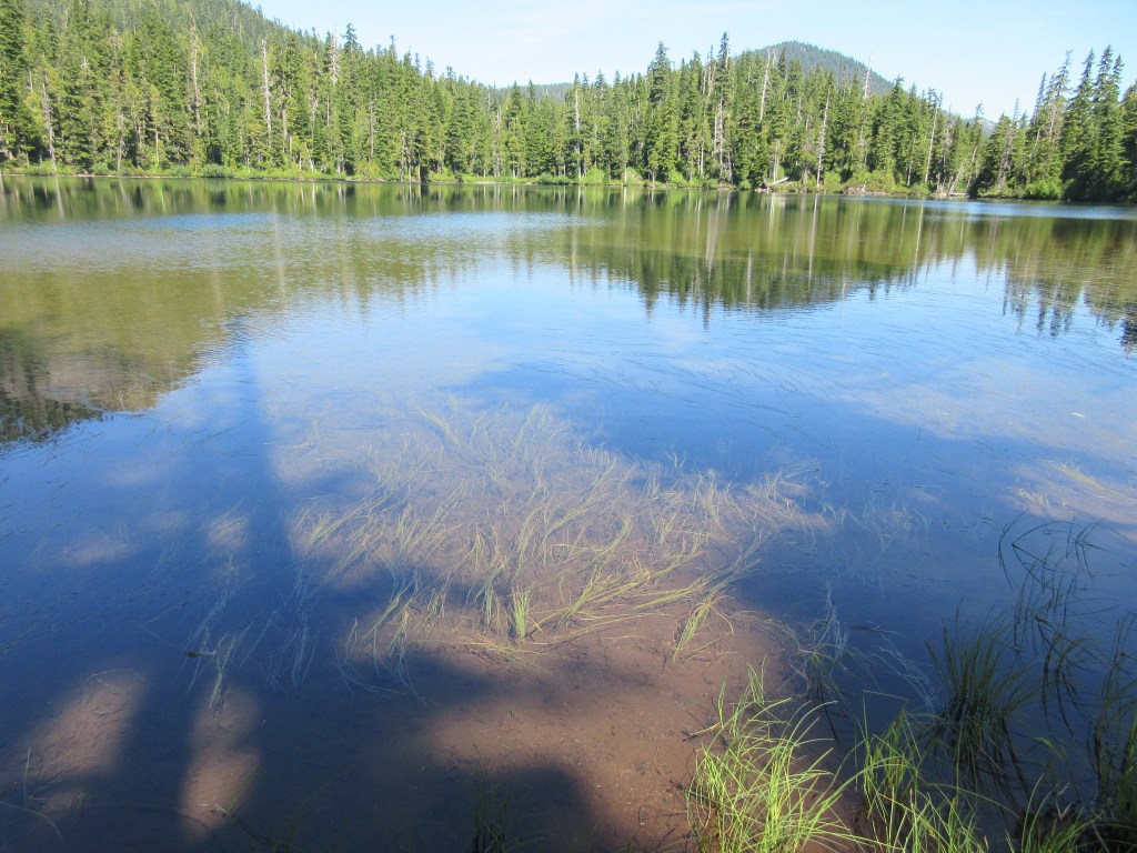
Seemingly uninhabited, Lake James I read feeds the Van Horn Falls. The lake looks shallow as the beach sides are also shallow. The lake I’m sure fills with grasses and the sunlight reaches the soggy bottom.
Lake James Camp was on our list to stay but it was “full”. We find that most of our trip has shown full campsites on paper but there must be a lot of “No Shows” because we see no one at Lake James and hardly no one on the trail either coming or going, person, squirrel, bear or ranger.
Sluskin
The Sluskin Range is named for the Native American, Sluskin who guided the first successful ascent of Mt. Rainier by Hazard Stevens and P.B. Van Trump in 1870. The mountains are named, The Chief, The Squaw and the smaller ones papooses.
History reads the name Sluskin was used in several generations after the Stevens and Van Trump summit as well. Native Americans from the Yakama Nation were given hunting rights and treaties were carried when they frequently hunted at Yakima Park adjacent to the Sunrise area of Mt. Rainier. Recounts of rangers coming into camp are now part of the park’s history.
My family has its own ties to the Yakama Nation. My great-great Uncle being the only non-native buried at Ft. Simcoe, Nathan Olney.
Fire at Redstone Peak
As we head from Lake James we notice a tall peak to the south. Large boulders have fallen all around. Trees appear lifeless, limbless and scorched at the trunks.
I spend the better part of a day researching the fire here. At the time of this writing the only mention I can find is there was a fire here and the next mountain over at Grand Park at some time in the 1960’s.

The trail is a steep gain to a beautiful alpine meadow where wildflowers are blooming and another perfect spot to bask in the sun contemplating lunch.
We stop near the top of Van Horn Creek to rest our feet and get lunch in this lovely picnic spot perfect for a break.
Across this area to the Natural Bridge, Crescent Lake and mountain, was the some of the most beautiful scenery on The Northern Loop. It felt like being in the Alps or at least the opening scene of The Sound of Music. Wildflowers, alpine lakes, craggy mountains topped with snow, meadows, walls of andesite, and easy trails made this section just after lunch a needed break to the uphill along Van Horn Creek.
Crossing down the backside of Windy Gap the switching back over 5 miles went quickly with the Carbon River Glacier ahead of us then back up to Cataract Valley Camp.


Yellowstone Cliffs
Towering to the North of Windy Gap the Yellowstone Cliffs emerge create a hidden spot in the wildflowers to have another backcountry camp. We take a short tour of the camp, with the signs of one group who appeared to have camped there.
This is where the trail descends 5 miles downhill to the Carbon River.
We literally saw no one the remainder of the day as we went across the Carbon River Suspension Bridge. Most hikers would have been at camp by now but our had been long and arduous. A solo woman hiker who didn’t speak to us, probably because she had equally as long of a day, was going to Carbon River Camp as she turned downhill. The sign at our junction pointed us up where we encountered a couple who encouragingly told us Cataract Valley Camp wasn’t too far after a long, long day.
The upper part of the Wonderland trail here became heavily used. The steps up were rocky and steep, worn by boots and people. Coupled with my legs not wanting to move at the end of the day, my backpack felt heavier and my trekking poles were a blessing that gained me additional help up.
As we crossed the Carbon River we gave our thanks and said our good-byes to the lovely, peaceful, serene spectacle that was The Northern Loop Trail.
Video for Episode 9 You can click and watch.
Happy New Year 2021


Happy New Year to my followers and fellow lovers of the outdoors.
Wishing you a happy New Year with the promise of better times ahead for all of us.
-Lisa
Wildflowers of Berkeley Park, Trail Running and Sustainability

The following is a prelude to Video Episode 7 Wildflowers of Berkeley Park. You can click here to play video or read and watch at the end.
Video Synopsis: Now on the Northern Loop Trail, Episode 7 takes us through Berkeley Park wildflowers and a lovely creek that meanders parallel and gives us perfect background music to a relaxing and lovely day. Runtime 6:55
Day 8
Headed for the Northern Loop Trail, we leave Sunrise Camp directly to the cache to resupply for the next 3 nights and 4 days. It is already getting warm with the extra weight but most of Berkeley Park is downhill.
We meet several groups of people enjoying the brilliant wildflower display that makes this hike so delightful in August. Like Summerland, a hill that blooms from the bottom up most of the month of August. As if planned for us our coming, the entire hill was in bloom.
I think about how each lovely arm on the north side has been nothing short of a showcase. To the far northeast of Sunrise the seven lakes glisten next to path below the Sourdough Ridge an intense blue. Forest Lake with a peek into a past glacier with enormous rocks chiseled and carved with water and freezing temperatures, the last remainder of time past. Then down the Huckleberry Creek area, a lovely jade green forest and spa camp. Now the Berkeley Park trail, showing off every color it can in a buzzing fury of insects.

We aren’t at Berkeley Camp long when a couple a long way from home arrive at camp. Berkeley Camp is a small camp like a bed and breakfast and you must walk by other sites to either go to the pit toilet or to filter water in the creek, making it impossible to avoid the other campsite.
While hanging my food at the bear pole, we exchange greetings and have a short one-sided exchange about plans. I never say too much that wouldn’t make me feel safe as a female in woods. The couple proceeds to tell me about all their forthcoming accomplishments, together they are hiking The Northern Loop, then the man was going to run around the mountain by himself supported by a commercial group he had paid that would help him. There is nothing humbling in this exchange. That means, a commercial company helps him finish, feeds him, sets up his tent, gives him encouragement, praise, food, shelter, and whatever else it takes to allow him bragging rights.
We pick a site, the one with the stump kitchen, that gives us a little forest cooking table and logs to sit on and carry on with our routine of filtering water, organizing the insides of tents, and decide to have an early evening since tomorrow is a long day.

Running the Wonderland
First, I want to say I am a runner. My runs have been at the most half marathons and 5ks. I run all winter and early spring to train for hiking season.
The last few years however, there have become more and more of supported groups of ultra runners on the Wonderland Trail. Most backpackers have something to say about them in forums on the internet. At times it seems they do not get along with one another.
While I am all about creating access to the wilderness and believe trails are for everyone. I also believe trail runners, like hikers and backpackers do cause an impact to the environment and need to adhere to trail etiquette. Since trail runners can finish so quickly with assistance, they also need a way to marshal their numbers with a permit system.
There are truly only a few really stellar endurance athletes that can run The Wonderland Trail without someone by their side or close by. My advice is if you cannot run over 100 miles at sea level do not attempt this, use it as a training ground in order to tromp the vegetation, scare the critters and ask backpackers to step off the trail or if they have an aspirin or ice pack.
The fact that runners can do this quickly means they don’t need a permit to be there. Companies that get paid good money, get away with sending literally hundreds of people to the trails.
It goes without saying , furthermore we will have nothing left of the fragile alpine meadows with this kind of attack by humans.
Trail runners also have a long way to go as far as etiquette.
On more than a few occasions during our time up a hill with heavy backpacks, we were forced off to the side. One young lady with nothing but her shorts and tank top, telling us how much she loved the wildflowers as she made her way down the narrow path through the meadow. My thought was if you have two men on the sides of you, assisting you, you do not respect the wildflowers.
Another time I was approached from behind and elbowed to make room and move. The excuse came later after the two runners could finish and get their breath.
Then there is the occasional runner who doesn’t even step off trail and stop, they just run down the meadow, or up the meadow, avoiding the trail all together.
I truly hope they do stop to look at the scenery. I truly hope they stop to appreciate the beauty of a wildflower and mostly I truly hope they advocate to protect it now that they’ve seen it.
Trail runners need to start a permit system and adhere to a code of environmental ethics and we must be respectful of one another, above all respectful of the environment that has no voice.


Watch Video Episode 7 Wildflowers of Berkeley Park.
