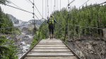
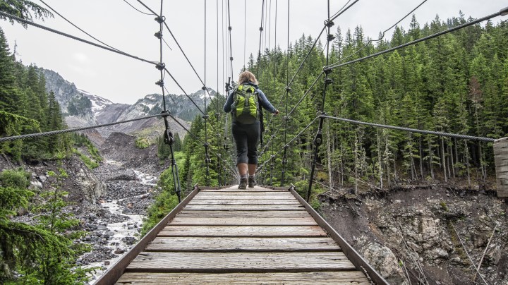
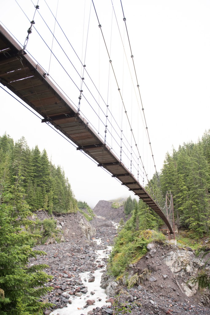
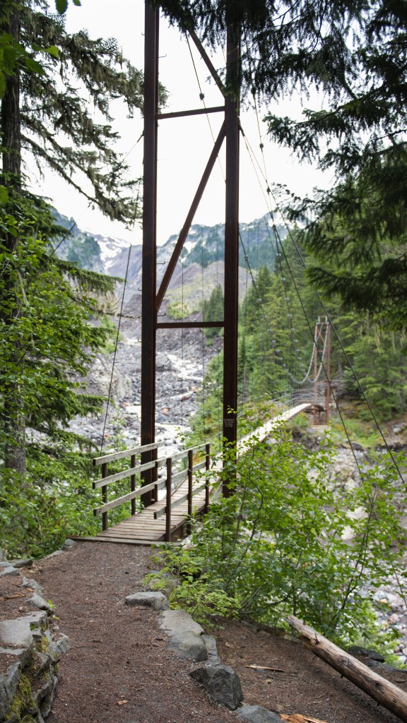
Westside Road Tahoma CreekRoute– My husband and me were out for a day hike at Mt. Rainier. We veered off onto the West Side Road and followed it to the end at approximately three miles and parked at the small lot. Beyond that we walked up the road to the Tahoma Creek Trail Head (somewhat hidden) but look for a red piece of duct tape on a stick on top of a stump, a barrel or some kind of unmaintained trail head marker about 1 1/2 miles up the road. Next we entered a trail for 100 yards toward the Tahoma Creek. Next we followed pink markers staying close to the forest and in the smaller rocks. The Tahoma Creek often changes direction and floods often. Staying close to the smaller creek until the trail picked up again we set some markers on our Garmin so we could find our way back for a total of about 2.5 miles to the suspension bridge. 6 miles, and slight gradual elevation gain. By far my favorite route. The last two years it has become rather sketchy and unsafe along the unmaintained portion of the Tahoma Creek due to repeated flooding and washouts.. What makes this one my favorite is the Tahoma Creek Suspension Bridge that you get to walk across.
Click this picture below to watch the video of the Tahoma Creek Suspension Bridge. It swings and bounces and recommended only one person at a time.
Wildflowers on the Skyline Trail, Paradise, Mt. Rainier National Park
My Top 10
#1 Indian Henry’s Hunting Ground is by far my favorite day hike in the park.
A great part of this hike is on the Wonderland Trail. I’ve started at three points to make it a day hike between 12-14 miles.
Indian Henry’s Hunting Ground is at minimum 12 miles and several thousand ft in elevation gain, along with several pushes up and over a ridge that puts you in sloping meadows carpeted with huckleberries and laced by little creeks: a precursor to your final destination. Continue on, arriving at a trail junction in Indian Henry’s Hunting Ground, two and a half miles from where you joined the Wonderland Trail.
From this junction there are plenty of options for exploration. Take the trail branching to the left to visit Mirror Lake, or continue straight on and arrive at the ranger’s cabin in about a quarter mile. From the patrol cabin that dates back to the 30’s, rest up and imagine So-To-Lick also know as Indian Henry living up here, hosting explorers and guiding them up the enormous mountain looming overhead. It was said he had three wives and many thought he came to this location because he had a secretly hidden gold mine. Mostly it was to hunt.
Indian Henry’s Patrol CabinIndian Henry’s Patrol CabinWildflowers in Early August, Indian Henry’s Hunting Ground
Longmire Start– StrenuousRoute– 14 miles, 3,200 elevation gain. This by far was one of the hardest hikes I have been on in a day. This particular day I was with my longtime friend Diane. The forecast was for in the upper 90’s in Puyallup and we thought we would escape the heat and head to the mountain. I had shorts and tank top on, bug spray, lunch and a couple of water bottles. Good enough! As the elevation and climb started, I began to really heat up, then pour sweat that attracted hundreds of thirsty mosquitos.
After repeatedly having Diane spray my back and head to no avail I was pretty much eaten alive. We continue on, not taking any breaks so the bugs couldn’t swarm and with working at that intensity in the heat, I decidedly and thankfully drank all my water.
After reaching Indian Henry’s Hunting Ground, it was good thing I remembered a small little lake behind the patrol cabin about another mile north called Mirror Lake or I might have ended up drinking unfiltered water ripe with mosquito larva. I yanked off my boots, jump in and swim around with the salamanders for an immediate shock of relief. It probably saved my bacon as well. Walking back with wet clothes was a rather nice way to end the trip.
Kautz Creek Start– StrenuousRoute– 11 miles, 3,800 elevation gain. This particular hike Diane and me have done quite a few times but the day I attempted to showcase the beauty to my friend Tammi, her husband Paul and my Krysta and her husband Corey was misery.
The day we picked it was raining. You would think we would all be used to it but this rain was relentless and hard. It was early spring so I just stripped down to a tank top and base layer leggings and wrapped all my clothes tightly in a plastic garbage bag and stuffed them in my backpack.
The rain just cascaded down the steep steps going up the Kautz trail making the steps washed out and even steeper. By the time we made it to the patrol cabin there was another group of 6-8 standing at the porch, all in big heavy ponchos. We wedged our way in and had a nice chat with them since they were doing the Wonderland and had young teens with them from Puyallup.
After lunch and rethinking my trip up and all the water, I eventually put on every layer I had carried up, buttoned up, zipped up and covering every body part, I high-tailed it down the hill.
We never did see the mountain that day.
Westside Road Tahoma Creek Start Route– 12 miles, 2,502 elevation gain. Strenuous but by far my favorite route. The last two years it has become rather sketchy and unsafe along the unmaintained portion of the Tahoma Creek due to repeated flooding and washouts.. What makes this one my favorite is the Tahoma Creek Suspension Bridge that you get to walk across.
Tahoma Suspension BridgeTahoma Creek Suspension BridgeTahoma Creek Suspension BridgeTahoma Creek Suspension Bridge