This January, I set goals for two hikes per week in addition to my regular gym and and replacing my endurance running workout.
Since I recently trained and finished a 1/2 marathon in December, my body felt sore, tight and fatigued, so I took a well deserved running break. I also had some hamstring tightness that resulted in high hamstring tendonitis. It took about 6 weeks of recovery with no sprinting or high knee stepping at the gym. I also saw an acupuncturist for 3 non-invasive treatments to the area with the TENS unit hooked up to me.
Note: The best advice I can give you with any injury or before embarking on daily physical training is see a doctor. During your training make sure you have adequate rest and nutrition. Needing a nap at noon everyday, or having frequent injuries is a sign of overtraining, not enough calories or both.
Since my endurance training has now been replaced with hikes, I will need to pay close attention to my weekly workout and calories. Some of my endurance training will count as endurance, while others days are simply beautiful urban hikes which refuel my recovery and add to my rest days and spirit.
Training Gadgets
Regardless of what I am doing, I always wear a heart rate monitor so I can look at my cardiac output. As you train, your body will become both more efficient and requires more calories.
I have learned to either wear the Garmin belt that goes with my Fenix 5s or MyZone purchased at the gym I belong to Find Your Fit in Puyallup.
Best Hikes for Training
I have ranked these in order of best training hikes closest to home and what the demands of the Wonderland Trail are.
Winter Safety
Always carry the 10 essentials, bring waterproof poncho, handwarmers, microspikes, snowshoes, shovel, chains for snow parks. Familiarize yourself with Northwest Avalanche Center where you’ll find there are many great videos on snow safety in the back country and stop by ranger stations for trail reports before heading out.
- Snowshoe at Elevation with Weight
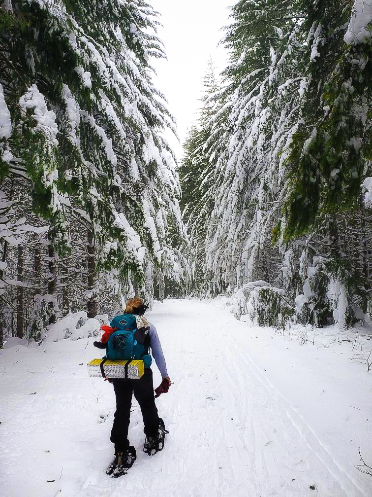
Located in Ashford, the Mt. Tahoma Trails Association is a hut to hut cross country ski or snowshoe trail. My first snowshoe this year was late, January 18th. I wore MyZone so I could figure my calorie output. For the day, with a 20 pound weighted pack and snowshoes 3,000 calories. Garmin recorded a 14 mile trip with 1,800 elevation gain to 4,200 ft. More on why I wear both to train in the gear section and nutrition section. Washington Trails Association Trip Report
2. Hiking at Elevation with Weight
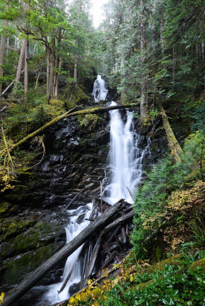
At the Carbon River Entrance to Mt. Rainier, hike the road 5 miles and hike up to the falls another 1 mile. This was my 2nd hike of the week after a snowshoe. I had a 20 pound pack, 1,700 calorie burn. Garmin recorded 12 miles, 1,000 ft elevation gain to 2,800 ft. It was icy that day, with 18″ of snow up at the falls and pouring rain. I felt disoriented in the snow and didn’t want to go off trail so we turned around. This photo is from a previous trip in the fall. We used trekking poles and had microspikes. My stove didn’t work, so I ate a protein bar and strawberries and carrots. My fingers were frozen, I took a hot shower and a bath later that evening. Washington Trails Association Trip Report
3. Lowland Hiking or Run with No Weight

Located in Eatonville, the Pack Forest a University of Washington research center is open to the public and has miles of beautiful hilly trails. Pictured is the Mashel Falls. I hiked with no pack. Garmin recorded 6.28 miles with 1000 elevation gain to 1,200 ft. I started here first, December 29th. MyZone 478 calories. If I would have gone for a trail run, it would have killed me. After 3 weeks off from the 1/2 marathon and eating bad causing inflammation and tendonitis. Washington Trails Association Trip Report
4. Hilly Urban Trails with Weight

Clark’s Creek Park Loop is located in Puyallup, Wa. Hike the loop a few times and you can get a 9 mile hilly course. Garmin recorded 350 calories in one loop. You can see right away where elevation and adding weight to your load makes a significant difference in training effect. This one begins at sea level and reaches 350 ft but its access makes it appealing to many people training. Washington Trails Association Trip Report
5. Flat Nature Trails

Pt Defiance Park has an abundance of nature trails. Garmin measured the loop at about 5 miles. Calories 400 at sea level and 420 ft at the highest point. Just breathing in the abundance of oxygen completely restores me. Washington Trails Association Trip Report
