
The following is a prelude to Episode 9 Video. You can click and watch here or read and click the link at the bottom.
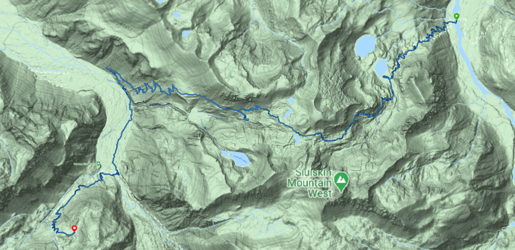
Video Synopsis: Episode 9 finds Lisa and Shannon covering the most mileage of the entire trip with over 6600′ vertical gain and 6600′ vertical loss. Lisa finds trail miles are a lot longer than regular miles as she pushes across the Carbon River Suspension Bridge with still another uphill climb with epic scenery hardly ever viewed. Runtime 12:25
The Big W– Where the Boots Meet the Trail
We plan to leave early, breaking down camp before breakfast around 6 am. The decision last night was to get to bed early, put a few miles behind us and to cross a sketchy river crossing at the West Fork of the White River in order to enjoy breakfast stretched out in the early sunshine.
Shannon titled this day the BIG W due to the elevation loss, gain, loss and then gain again. Her title made it simply understandable of the amount of miles ahead of us this day.
Planning ahead, if the miles wouldn’t challenge us enough, the West Fork of the White River crossing known to be hazardous, and the elevation gain and loss certainly could. Reports of years of downed timber and limbs and blow downs strewn everywhere, we wanted to put this section behind us early. Recent reports had been good that the foot bridges were in place and stable so our positive outlook remained optimistic.
Remote and seldom maintained by the park due to limited access to get trucks or machines to the area, rangers and crews on foot carry chainsaws and hand tools to do the work Mother Nature and her forces push at them each winter. I remember seeing a trail on a map that continues down the east side of the West Fork of the White River. Just as we start heading west to cross the map showed further north leading to the boundary and possibly a forest service road that is used to maintain the trail crossing.
Other than that, this portion of the Northern Loop is an often overlooked by backpackers as a must do. Most prefer to go on The Wonderland running inside and closer to the mountain.

Early Morning Hike to the West Fork of the White River
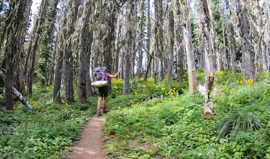
Along the southern ridge we could see the deep valley below with the West Fork of the White River. We survey the river towards then up towards the mountain leading to the Winthrop Glacier. The forest floor exploding full of bright green foliage and yellow wildflowers. Around the corner of the ridge, the trail now down switches back and forth and back and forth and back and forth with long easy switchbacks lasting miles.
This forested section appears very dry comparatively to the other lush areas of the wet landscape of Rainier. The dropped needles on our path look dry and hardy. There were minimal trickles and creeks spilling across the trail, which made the trail a gradual slopped descent to the river. The trees still towering above were smaller in size and meek in girth. We saw no one as The Northern Loop is very much isolated as predicted compared to The Wonderland Trail.

Hearing the river below as we near the crossing, then seeing it before us, helped push our mental state through the delta of silt. This hard to find trail has been diverted several times over the years and it could take some bushwhacking and common sense. My thoughts were how difficult the navigation must be in the snow early season or depending on the time of day or the time of year.
When we see the sign to the crossing, indeed showing there is a way to continue north to the park boundary, we have already started picking huckleberries and eating them. We imagine fairy gardens on logs and are entertained by the mushrooms and moss that could be hiding little people.


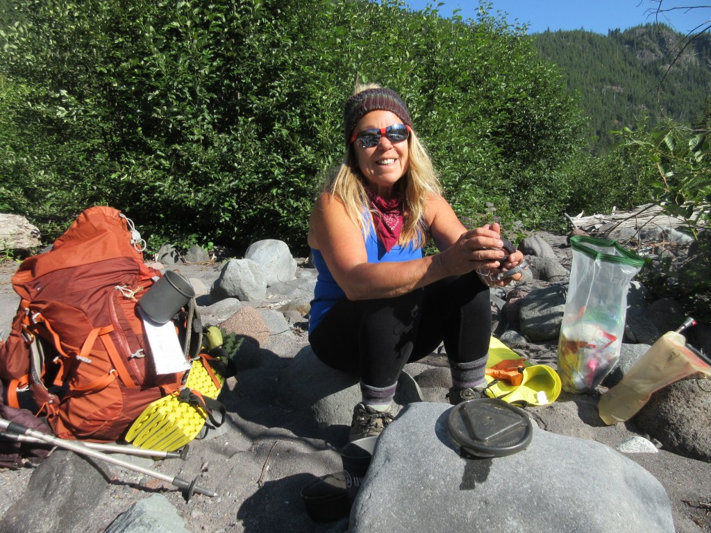
Breakfast at the West Side of the West Fork of the White River
I’m sure Shannon would agree this one of the nicer places to have breakfast. We pull out our stoves, take off our packs, boots, coats, and bask and enjoy our little outside diner complete with fairy gardens, water features and the sights and sounds of the morning.
Van Horn Creek and Falls
At Van Horn Falls we come across two men who appear dressed in street clothes. They seem as startled as we do. After seeing no one for hours, imagine coming across two younger men out in the middle of no where. We stop to filter water and a brief hello to survey the falls.

A Mountain to Climb
Still continuing on The Norther Loop Trail, we begin the steep ascent next to Redstone Peak, a mountain range to the north and slightly west of Rainier. Beyond will be Lake James, Lake James Camp then a range with jagged mountain peaks with names like Sluskin of Native American legend, dotted with lakes.
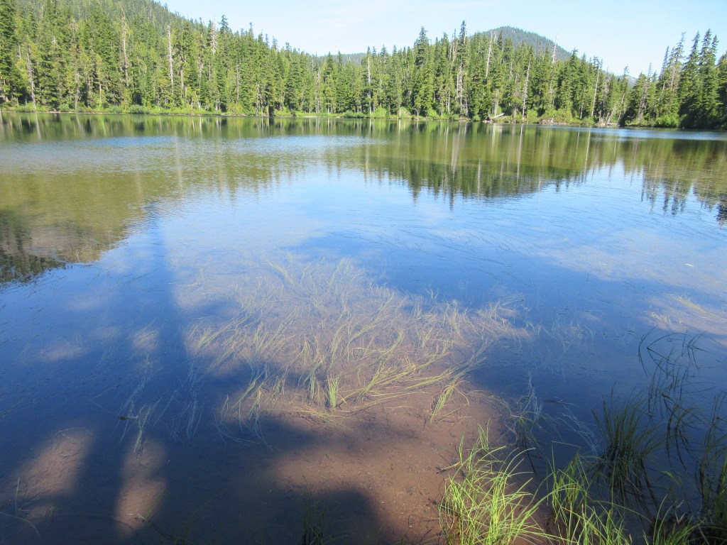
Lake James
Seemingly uninhabited, Lake James I read feeds the Van Horn Falls. The lake looks shallow as the beach sides are also shallow. The lake I’m sure fills with grasses and the sunlight reaches the soggy bottom.
Lake James Camp was on our list to stay but it was “full”. We find that most of our trip has shown full campsites on paper but there must be a lot of “No Shows” because we see no one at Lake James and hardly no one on the trail either coming or going, person, squirrel, bear or ranger.
Sluskin
The Sluskin Range is named for the Native American, Sluskin who guided the first successful ascent of Mt. Rainier by Hazard Stevens and P.B. Van Trump in 1870. The mountains are named, The Chief, The Squaw and the smaller ones papooses.
History reads the name Sluskin was used in several generations after the Stevens and Van Trump summit as well. Native Americans from the Yakama Nation were given hunting rights and treaties were carried when they frequently hunted at Yakima Park adjacent to the Sunrise area of Mt. Rainier. Recounts of rangers coming into camp are now part of the park’s history.
My family has its own ties to the Yakama Nation. My great-great Uncle being the only non-native buried at Ft. Simcoe, Nathan Olney.
Fire at Redstone Peak
As we head from Lake James we notice a tall peak to the south. Large boulders have fallen all around. Trees appear lifeless, limbless and scorched at the trunks.
I spend the better part of a day researching the fire here. At the time of this writing the only mention I can find is there was a fire here and the next mountain over at Grand Park at some time in the 1960’s.

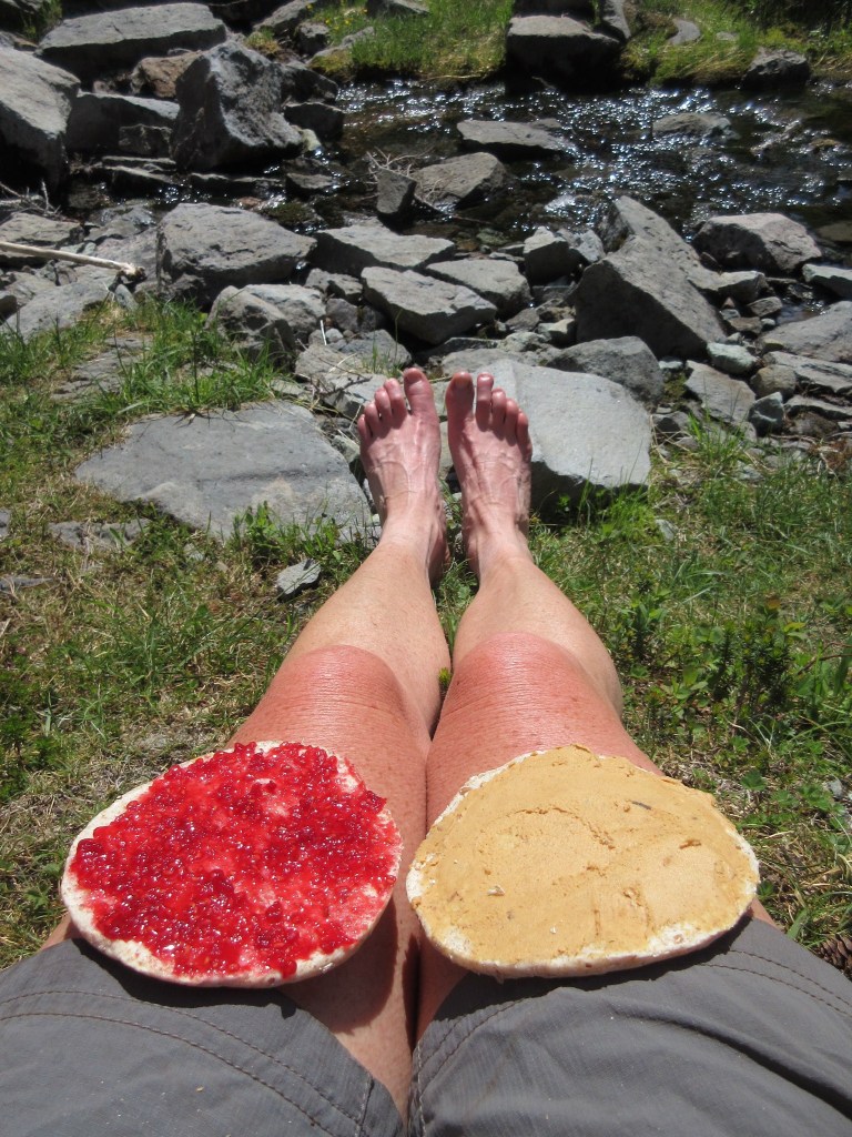
The trail is a steep gain to a beautiful alpine meadow where wildflowers are blooming and another perfect spot to bask in the sun contemplating lunch.
We stop near the top of Van Horn Creek to rest our feet and get lunch in this lovely picnic spot perfect for a break.
Across this area to the Natural Bridge, Crescent Lake and mountain, was the some of the most beautiful scenery on The Northern Loop. It felt like being in the Alps or at least the opening scene of The Sound of Music. Wildflowers, alpine lakes, craggy mountains topped with snow, meadows, walls of andesite, and easy trails made this section just after lunch a needed break to the uphill along Van Horn Creek.
Crossing down the backside of Windy Gap the switching back over 5 miles went quickly with the Carbon River Glacier ahead of us then back up to Cataract Valley Camp.


Yellowstone Cliffs
Towering to the North of Windy Gap the Yellowstone Cliffs emerge create a hidden spot in the wildflowers to have another backcountry camp. We take a short tour of the camp, with the signs of one group who appeared to have camped there.
This is where the trail descends 5 miles downhill to the Carbon River.
We literally saw no one the remainder of the day as we went across the Carbon River Suspension Bridge. Most hikers would have been at camp by now but our had been long and arduous. A solo woman hiker who didn’t speak to us, probably because she had equally as long of a day, was going to Carbon River Camp as she turned downhill. The sign at our junction pointed us up where we encountered a couple who encouragingly told us Cataract Valley Camp wasn’t too far after a long, long day.
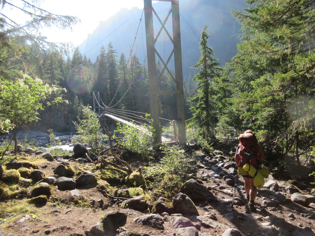
The upper part of the Wonderland trail here became heavily used. The steps up were rocky and steep, worn by boots and people. Coupled with my legs not wanting to move at the end of the day, my backpack felt heavier and my trekking poles were a blessing that gained me additional help up.
As we crossed the Carbon River we gave our thanks and said our good-byes to the lovely, peaceful, serene spectacle that was The Northern Loop Trail.
Video for Episode 9 You can click and watch.
