
My Top 10
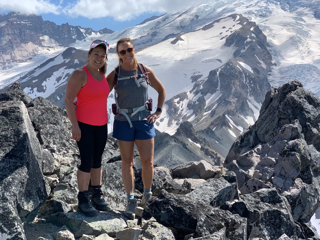
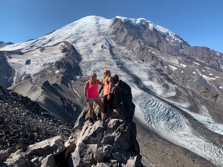
#1 Indian Henry’s Hunting Ground is by far my favorite hike in the park.
A great part of this hike is on the Wonderland Trail. I’ve started at three points to make it a day hike.
12 miles and several thousand ft in elevation gain, along with several pushes up and over a ridge puts you in sloping meadows carpeted with huckleberries and laced by little creeks: a precursor to your final destination. Continue on, arriving at a trail junction in Indian Henry’s Hunting Ground, two and a half miles from where you joined the Wonderland Trail.
From this junction there are plenty of options for exploration. Take the trail branching to the left to visit Mirror Lake, or continue straight on and arrive at the ranger’s cabin in about a quarter mile. From the cabin, rest up and imagine So-To-Lick living up here, hosting explorers and guiding them up the enormous mountain looming overhead.


Longmire- Strenuous Route– 14 miles, 3,200 elevation gain.
By far was one of the hardest hikes I have been on in a day. This particular day I was with my longtime friend Diane. The forecast was for in the upper 90’s in Puyallup and we thought we would escape the heat and head to the mountain. I had shorts and tank top on, bug spray, lunch and a couple of water bottles. Good enough! As the elevation and climb started, I began to really heat up, then pour sweat that attracted hundreds of thirsty mosquitos.
After repeatedly having Diane spray my back and head to no avail I was pretty much eaten alive. We continue on, not taking any breaks so the bugs couldn’t swarm and with working at that intensity in the heat, I decidedly and thankfully drank all my water.
After reaching Indian Henry’s Hunting Ground, it was good thing I remembered a small little lake behind the patrol cabin about another mile north called Mirror Lake or I might have ended up drinking unfiltered water ripe with mosquito larva. I yanked off my boots, jump in and swim around with the salamanders for an immediate shock of relief. It probably saved my bacon as well. Walking back with wet clothes was a rather nice way to end the trip.

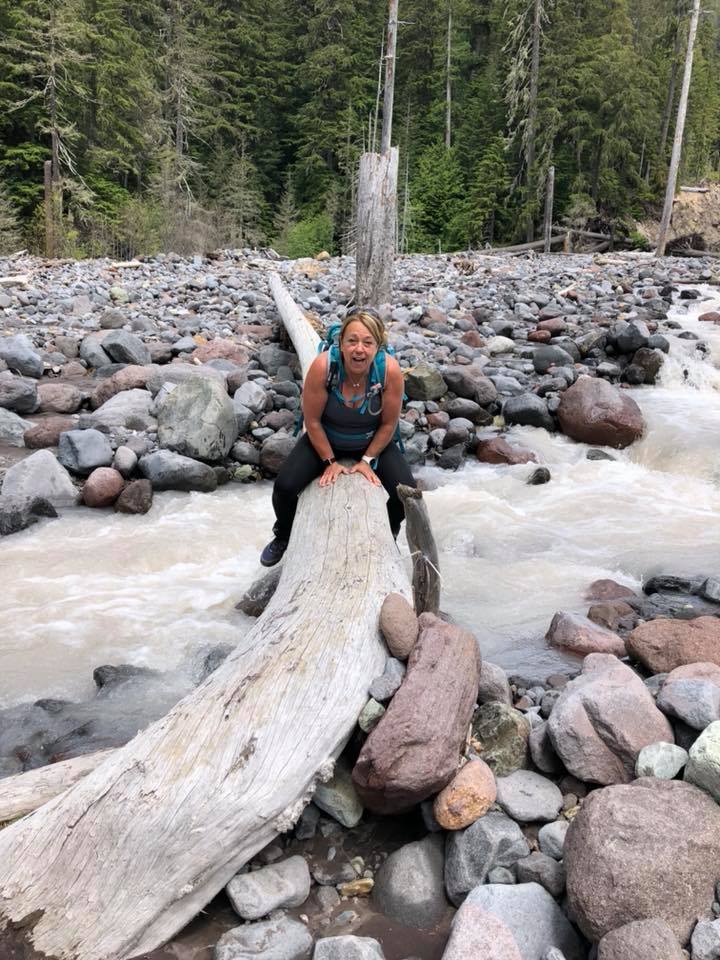
Kautz Creek-Strenuous Route– 11 miles, 3,800 elevation gain.
This particular hike Diane and me have done quite a few times but the day I attempted to showcase the beauty to my friend Tammi, her husband Paul and my Krysta and her husband Corey was misery.

The day we picked it was raining. You would think we would all be used to it but this rain was relentless and hard. It was early spring so I just stripped down to a tank top and base layer leggings and wrapped all my clothes tightly in a plastic garbage bag and stuffed them in my backpack.
The rain just cascaded down the steep steps going up the Kautz trail making the steps washed out and even steeper. By the time we made it to the patrol cabin there was another group of 6-8 standing at the porch, all in big heavy ponchos. We wedged our way in and had a nice chat with them since they were doing the Wonderland and had young teens with them from Puyallup.
After lunch and rethinking my trip up and all the water, I eventually put on every layer I had carried up, buttoned up, zipped up and covering every body part, I high-tailed it down the hill.
Lesson here is if it’s going to rain, get wet, keep moving, and have extra clothes and a poncho, always.
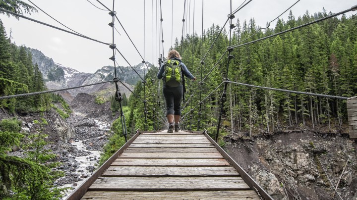
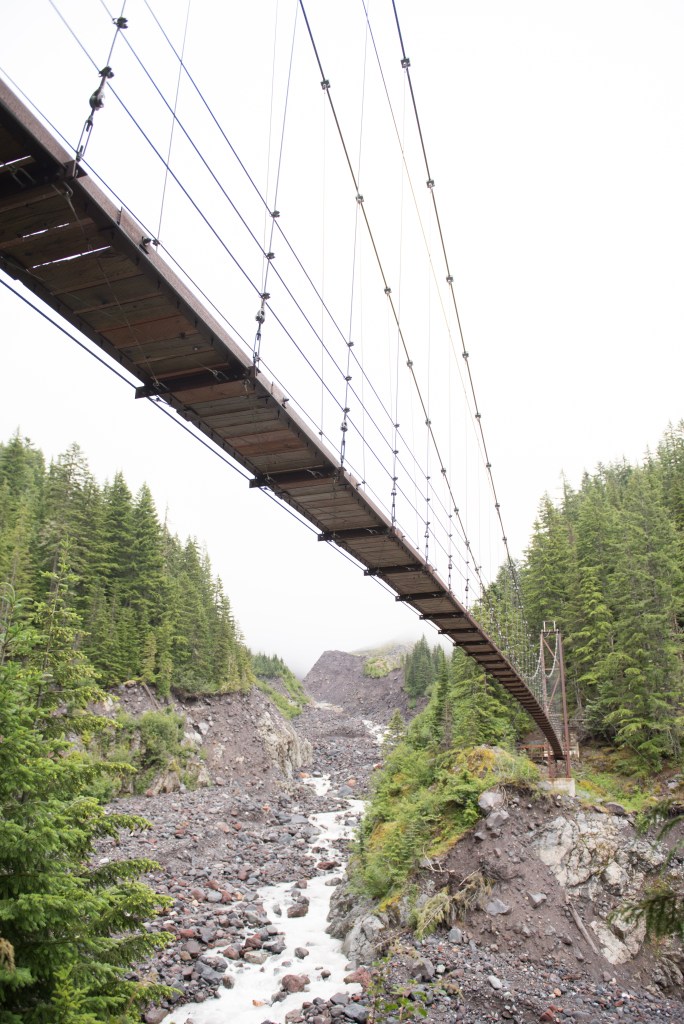
Westside Road Tahoma Creek Route– Strenuous 12 miles, 2,502 elevation gain. By far my favorite route. The last two years it has become rather sketchy and unsafe along the unmaintained portion of the Tahoma Creek due to repeated flooding and washouts.. What makes this one my favorite is the Tahoma Creek Suspension Bridge that you get to walk across.
Click this picture below to watch the video of the Tahoma Creek Suspension Bridge. It swings and bounces and recommended only one person at a time.

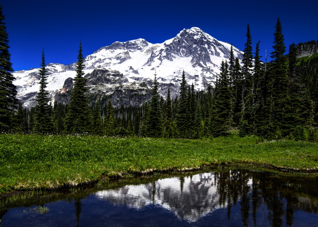
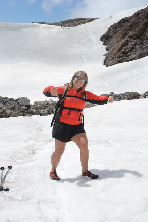
#2 Skyline Loop Trail, Paradise, Mt. Rainier National Park
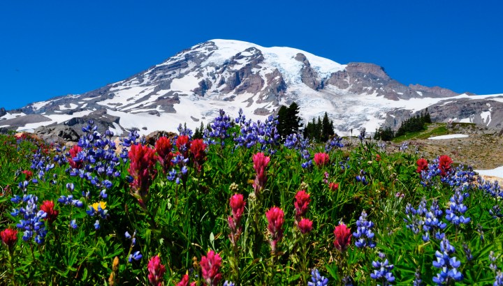
The Skyline Loop Trail is probably the most popular trail at Mt. Rainier National Park- Moderate 5.5 miles highest elevation at 6,200 ft. Best to go in August for wildflowers and marmots.
Video
Click for Video. It starts at the Paradise Inn and loops around vistas, waterfalls and sweeping views of Rainier. This day was in August with Tami.
Best to go on a bluebird day, you will hear languages from all over the world with differing abilities and equipment.

My favorite story has to do with when I was solo hiking here. It was a hot August day. I had my hydration pack in my day pack along with the tube that connects and extents out which then you drink from called a bite valve. I was heading up the hill and a lady was coming down. I had the bite valve in my mouth taking a sip. She responds to me, “I can make it up that hill without oxygen.” I told her she was absolutely amazing and not many can. Then she told me I didn’t have very much farther to go to the top. Hang in there”, she said.
Like I mentioned there are all kinds of people from all over the world there and it is also best treat others with respect. I also like watching the people in flip flops and shorts in the snow…
Also, the family dog (not allowed in the park), and the best was the family hauling a 1/2 case of beer up the hill for a picnic. Fun trip down I bet!

Photo Copyright by Lisa Elliott
My friend Diane and me used to just head up to watch the climbers who were training for the summit climb in how to self arrest. This is also a great spot to watch those folks yell out falling while hurdling themselves down a snow bowl and self arresting with their ice axes as we sat on the sidelines tanning our legs and arms.

We also met up with a solo climber who kept us at bay with his stories for half the day. Some were a bit far fetched and rather dangerous for someone climbing solo.


And wait until you see the luxury toilet at Panorama Point.
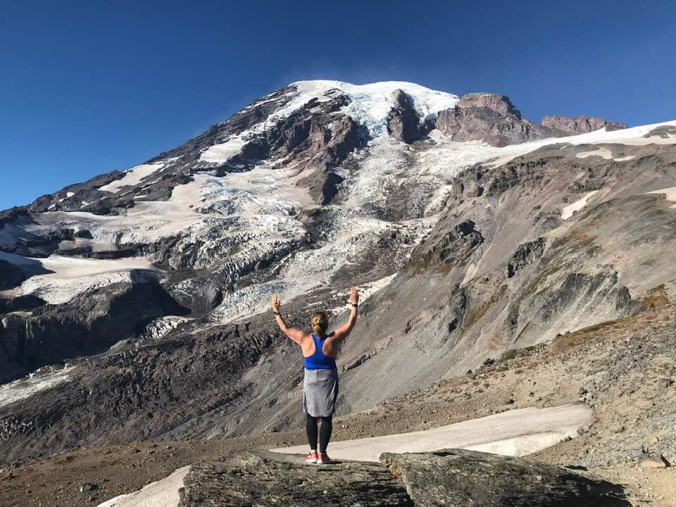
#3 Burroughs Three at Sunrise, Mt. Rainier National Park
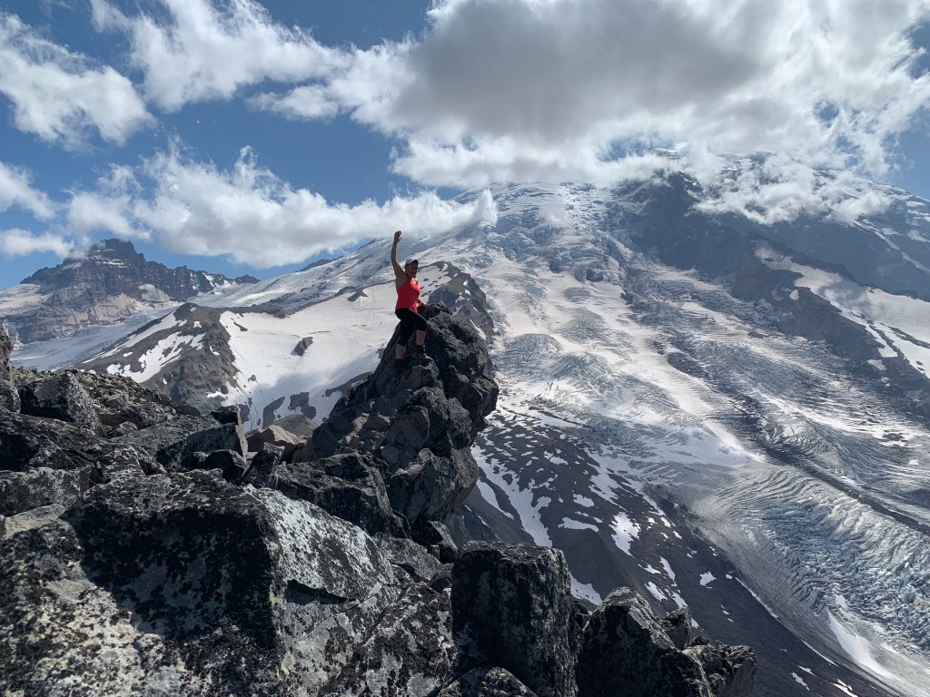
Photo Copyright Lisa Elliott
Burroughs Three– Strenuous- highest point 7,828 ft with elevation gain of 2,500 ft. Distance round trip is usually around 10 miles because we do a bit of exploring at the top and stop and have lunch. This is a taxing hike if you haven’t been running or hiking on a regular basis. It can also get hot but usually there is a cool breeze so bring layers.
Each summer I cannot wait to head up to the Burroughs. Burroughs is a set of three mountains in front of the biggest mountain in Washington State, Mt. Rainier. From each mountain, named one, two and three, you get a fire lookout view of the grandest of all.
Although hiking to Burroughs two is generally the stopping point for most people, if you venture up to three it is really spectacular. I took two videos this past summer of my trip. I took two other couples up there that really wanted to go.
Video
Click here for Video ONE taken in August with frequent hiking friend Tami and her husband Paul.
Video
Click here for Video TWO taken in September with another hiking friend Luellyn and her husband Chris. I used a GoPro handheld stick for these. Drones are not allowed in the park. I think I’ve been here with almost all my hiking people, Delia, Carrie, Audrey my husband Scott. Spectacular!
The details of this particular hike can be found here on my Garmin or at Washington Trails Association.


#4 Tolmie Peak Mowich Lake, Mt. Rainier National Park

Photo Copyright Lisa Elliott
Tolmie Peak Fire Lookout– Moderate 7.5 miles round trip with 1,100 elevation gain to 5,920 feet.
Named for Dr. William Fraser Tolmie. In August 1833, employed by Hudson’s Bay Company and stationed at the newly built Fort Nisqually, Tolmie made the first recorded exploration of the Mount Rainier area. Unable to summit Rainier itself, Tolmie and two Indian guides, Lachalet and Nuckalkat, summited one of the snowy peaks near the Mowich River headwaters. Although Tolmie Peak is named for this event, it is not known exactly which peak was climbed.
Driving to this location is half the fun! First the Fairfax bridge near the Melmont Ghost Town is spectacular and creepy to drive across its one lane. Next, 11 miles of potholes, which turn into craters later in the season, up the Mowich Lake Road in the northwest section of Mt. Rainier National Park.

Once you have arrived to the beautiful blue waters of Mowich Lake, you will feel like you are in the true wilderness. The mountain peeks around each turn and grows larger in your front window if you can see through the cascading dust. Some of the fool hardy, chance driving up this road in cars and end up with major damage. Make sure your friends help wash your vehicle when you return!
My best story is hiking it at night and waiting for the full moon to appear. As we hiked up rather early and picked our perch around the fire lookout, a few thousand mosquitos and pesky dear flies decided they would also camp-out with us…

Photo Copyright Lisa Elliott
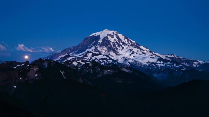
Photo Copyright Lisa Elliott
…we decided to get out the heavy artillery which means a large spray can of DEET and coverage. As four more hikers arrive on scene our insects decide to swarm in and invade them as our feet happily dangle off the porch and we finish our dinner. I then give an offering of my large can of DEET to our new arrivals which they gladly accept and in return “pass the bottle”. Now we are all happy as we watch an airplane buzz the fire lookout and the moon appears in the east as the sun sets in the west. Glorious evening.
Video of Mowich Blue Waters and the View

Photo Copyright Lisa Elliott

Photo Copyright Lisa Elliott

Photo Copyright Lisa Elliott

Photo Copyright Lisa Elliott
