The Cycle of Hope and Despair

dsc_1208
Mt. Rainier, Washington State

Changing Attitudes and Feelings

…Social Media

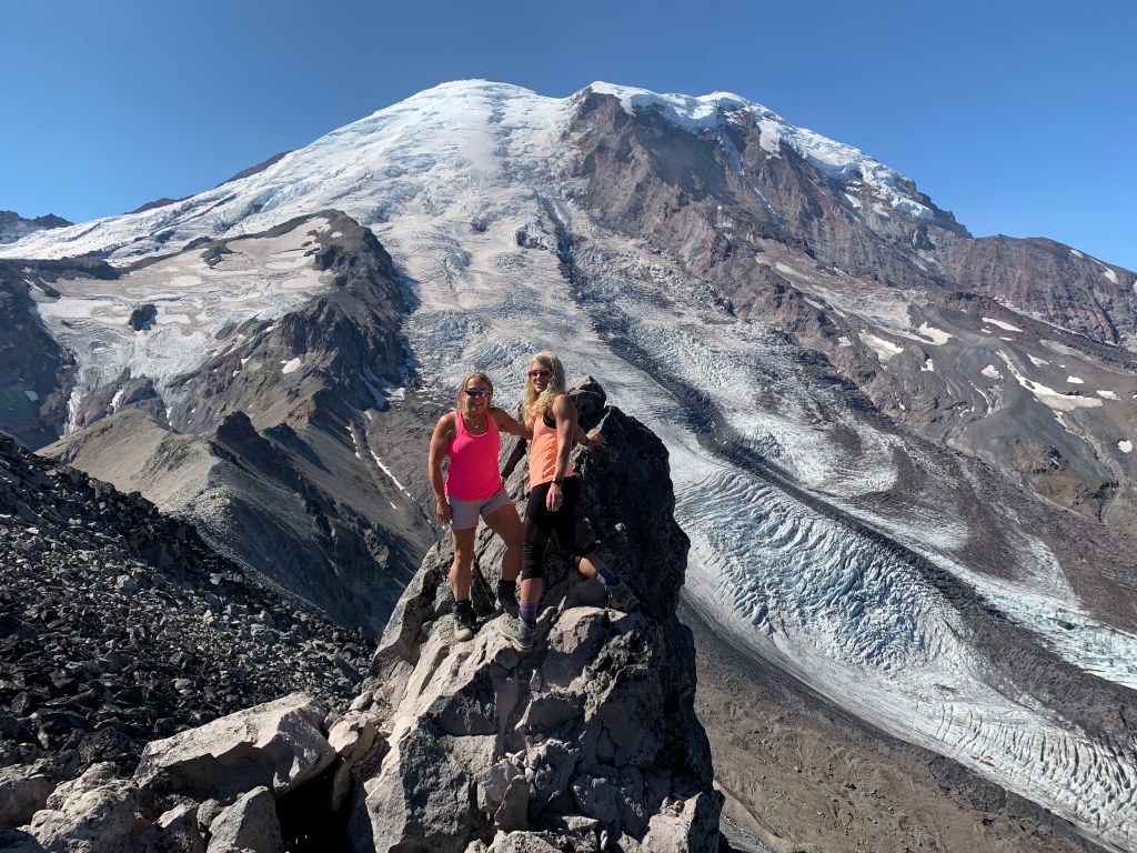
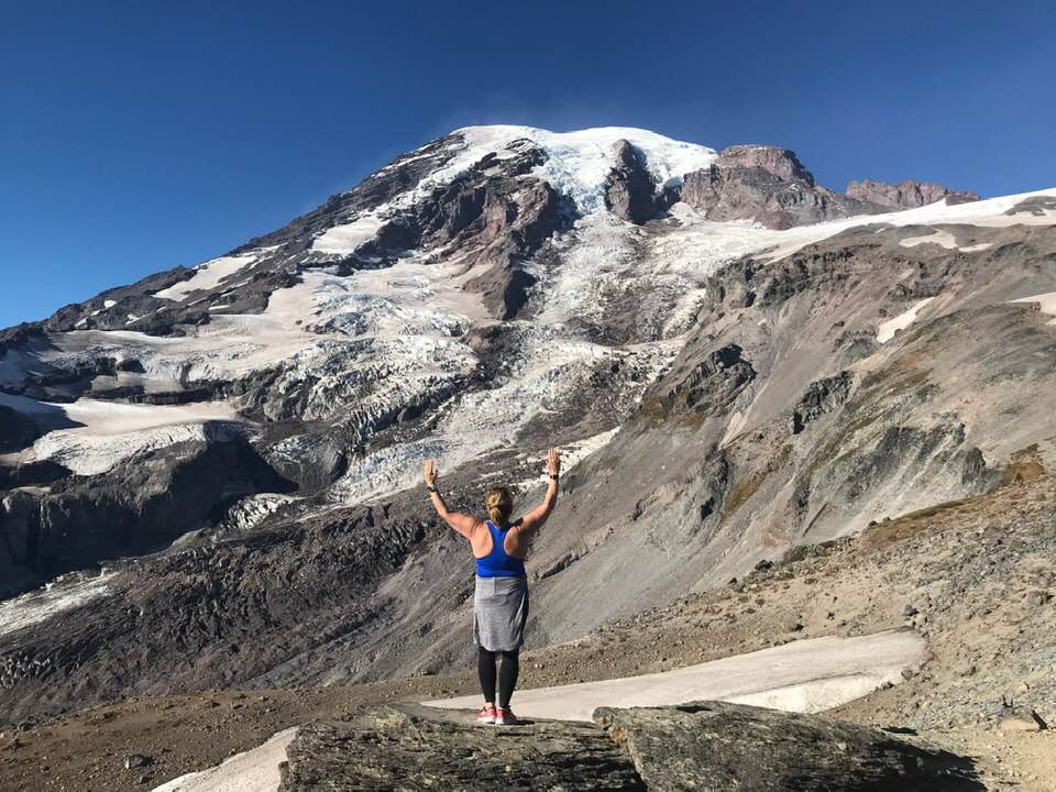
Over the past 10 years myself and many of my friends have shown gratitude on social media with an abundance of pictures of families, social outings, and travel. Like everyone, this is why we participate. As social media evolves, with these daily examples of life, it is clear we are beyond blessed and thankful, and show this each and every day of the week.

Many times I felt the struggle of guarded feelings of jealousy and being envious.

COVID-19 US Ground Zero

It is March 16, 2020, Washington State. Up the road, just east of Seattle is Kirkland. Life Center of Kirkland, had the first casualties from COVID-19 the past month. The virus is spreading from China, to Italy, most of Europe and the United States.

Within a month or less time, we moved from denial to acceptance. We have sent our kids home from school for six weeks, closed public places, and started to shelter in place. We collectively looked at facts as evidence and then became people who sought hope in our medical community and governing powers, more than seeking our own self recognition.

Hope can be fleeting, however. Hope is and will be challenging. It is a hard to maintain and even harder place to live. When hope dwindles you easily begin to drive down a road of despair. Just that fast.

When you loose hope together and willingly, despair consumes you.

The Cycle of Despair and Hope

Today it flipped for me. As my husband and I walked a few miles through the surrounding  neighborhoods, the lesson I saw was many people standing outside in their front yards looking for us to say hello or to stop. Keep in mind it is chilly here in Washington State, 35 degrees and breezy and clear. Yet I never saw so many people outdoors, cleaning the garage, working in the yard, playing with their dogs, walking.

 “I am good,” I say, “how about you” with a smile, not looking away and down at my phone like I would have done on any other given day. Today my glance lingered, my smile lasted a bit longer. Then it was apparent. I added a word of encouragement keeping my social distance.

Isolation Spreads Despair

No one wants to feel isolated and despair lives in isolation. Hope thrives when we are together even if it is at a distance. We need a reassuring smile to see we are still going on but, remember we have done it to ourselves when we feed into despair.

Togetherness Builds Hope

As I walked I continued to think hope will be the big idea and safety net today, especially in light with what’s around us. Observe, listen and above all else remain positive. We are learning a new way to navigate life and cope with fleeting hope for a short time.

When you become tired and weary let others lift you and don’t drive down that road of despair and take others with you.  I was headed there when I stepped out my front door feeling alone today.  Help each other, reach out from a distance.  We are in this together.

Take that step.

It’s Time to Submit for the Permit

Meet Candace. This week Candace and I met to go over our itinerary we are submitting for the Wonderland Trail. We have a few others who may hop on and off the trail along the way but mostly it will be just Candace and myself and then the potential of meeting close to 100 more folks that we have no idea who they are and they don’t even know who they are yet. In other words, it is a random lottery fest to see who gets the coveted permit within the desired window of time. Mt. Rainier National Park holds the statistics on the lottery with only a small percentage being issued ahead of time and most all handed out after appearing at the door of a ranger station ready to go.

I am sure I put too much thought into it but, the most popular and currently used book is Tami Asars, “Hiking the Wonderland Trail”. Since Tami Asars book is currently so popular, we picked the more leisurely 13 day trek and settled on submitting our permits for both counter-clockwise and clockwise, mid August, beginning at Mowich, a less desirable starting point.

Timing is everything and the later the better. Reason one we decided on mid August is, the snow pack is much higher this year and will more than likely put us a week or two later in the season.

Mowich is also less desirable for the following reason. Mowich Lake drive-in campground is an eleven mile dirt hole drive through potholes and mud until you arrive at your even more dusty location.

After you leave your vehicle there for over a week, no telling what could happen. You may not be able to find it with all the dust. There is also no running water and pit toilets. The one desirable thing about Mowich is the beautiful crystal blue serene lake.

Planning is hard work…

In the end, since the probability of being pulled out of a lottery for any itinerary published in Tami’s book is slim to none, coupled with the most desirable time to do the Wonderland being late July and August, I really thought through our strategy over and over again in my head in the middle of the night.

The window to submit is March 15th-30th this year. Here is where we started after meeting and then here is where we discussed again Tuesday and landed…

Here is my thinking why starting at Frying Pan Creek is most desirable….

First, the trailhead is in a good spot for one of the most challenging portions of the trip.

This trailhead leads to Summerland and the highest point of the Wonderland, Panhandle Gap. Panhandle Gap is usually always snow covered and there is a 2900′ elevation gain from the TH to the gap. The nice part about this is, we will stay at Indian Bar one night, then Nickel Creek day two. Our next cache is at Longmire, adjacent to our stay at either Paradise River or Cougar Rock or The National Park Inn.

2900′ elevation gain with two days of food sounds really desirable to me. It gives us a burger and a beverage at Longmire with our trip ending at Sunrise for another burger and adult celebration beverage.

After day hiking for years, I think Frying Pan Creek is most certainly the ticket!

I am using the Wonderland Guides Trail Planner to play around with several scenarios. It has online tools and easy guides to adjust days.

The best book currently available is Tami Asars Hiking the Wonderland Trail

Trail Grub and Snowshoe Video

Nothing is more important than good food on the trail.

A few weeks ago my friend Carrie and I ran into three ladies who had hiked the Wonderland Trail successfully a few years ago.

Since we were hut mates for the evening, Carrie, mostly picked their brains for the entire evening. Their food looked delicious and they talked about how many things they had dehydrated and dumped into ziplock baggies.

Ziplock baggies is key here because on the Wonderland it is pack it in and pack it out. You might find yourself with trash for days if you take the store brand sealable cooking pouch bags. Also if you’ve ever actually sampled those, they are hit and miss with taste with some of the desserts being overly sweet and lacking fresh taste.

When we returned after our stay at the hut, these recipes magically appeared in my email box.

I’ve also decided to dive into the world of dehydration. I should be able to do this with my oven that has low and convection settings.

Also important to note, a wonderful website TrailCooking.com

I’m doing the happy dance!

High Hut 1

Seated left to right:       Carrie, Lisa, Shannon, Susan, Catherine

Screen Shot 2020-03-12 at 6.19.56 AM

  Snowshoe Video


Reach out and Touch a Volcano

#3 Burroughs Three at Sunrise, Mt. Rainier National Park

This image has an empty alt attribute; its file name is img_1850.jpg
Burroughs Three, Sunrise, Mt. Rainier National Park
Photo Copyright Lisa Elliott

Burroughs Three– Strenuous- highest point 7,828 ft with elevation gain of 2,500 ft. Distance round trip is usually around 10 miles because we do a bit of exploring at the top and stop and have lunch. This is a taxing hike if you haven’t been running or hiking on a regular basis. It can also get hot but usually there is a cool breeze so bring layers.

Each summer I cannot wait to head up to the Burroughs. Burroughs is a set of three mountains in front of the big mountain, Mt. Rainier. From each mountain, named one, two and three, you get a fire lookout view of the grandest of all.

This image has an empty alt attribute; its file name is img_1852.jpg
Lisa and Tami

Although hiking to Burroughs two is generally the stopping point for most people, if you venture up to three it is really spectacular. I took two videos this past summer of my multiple trips this past summer. I took two other couples up there that really wanted to go. Click here for Video ONE taken in August with frequent hiking friend Tami and her husband Paul. Click here for Video TWO taken in September with another hiking friend Luellyn and her husband Chris. I used a GoPro handheld stick for these. Drones are not allowed in the park. I think I’ve been here with almost all my hiking people, Delia, Carrie, Audrey my husband Scott. Spectacular!

Lisa and Luellyn

The details of this particular hike can be found here on my Garmin or at Washington Trails Association.

This image has an empty alt attribute; its file name is img_1856.jpg
Paul and Tami
This image has an empty alt attribute; its file name is gopr0923.jpg

Skyline Loop Trail

Skyline Loop Trail

#2 Skyline Loop Trail, Paradise, Mt. Rainier National Park

This image has an empty alt attribute; its file name is 4922160446_dec57770c3_o2.jpg
Skyline Loop Trail, Paradise, Mt. Rainier National Park
Photo Copyright Lisa Elliott

The Skyline Loop Trail is probably the most popular trail at Mt. Rainier National Park- Moderate 5.5 miles highest elevation at 6,200 ft. Best to go in August for wildflowers and marmots.

Video

Click for Video. It starts at the Paradise Inn and loops around vistas, waterfalls and sweeping views of Rainier. This day was in August with Tami.

Best to go on a bluebird day, you will hear languages from all over the world with differing abilities and equipment.

This image has an empty alt attribute; its file name is edith-creek.jpg
Edith Creek, Skyline Loop, Paradise, Mt. Rainier
Photo Copyright by Lisa Elliott

She Can Climb It Without Oxygen

My favorite story has to do with when I was solo hiking here. It was a hot August day and I my hydration pack in my day pack along with the tube that connects and extents out which then you drink from called a bite valve. I was heading up the hill and a lady was coming down. I had the bite valve in my mouth taking a sip. She responds to me, “I can make it up that hill without oxygen.” I told her she was absolutely amazing and not many can. Then she told me I didn’t have very much farther to go to the top. Hang in the there.

Like I mentioned there are all kinds of people from all over the world there and it is also best treat others with respect. I also like watching the people in flip flops and shorts in the snow…

Like I’ve never done that!

…the family dog (not allowed in the park), and the best was the family hauling a 1/2 case of beer up the hill for a picnic. Fun trip down I bet!

This image has an empty alt attribute; its file name is 11258227_10200848442650487_5423003256099362824_o.jpg
Skyline Loop Trail, Paradise, Mt. Rainier
Photo Copyright by Lisa Elliott

My friend Diane and me used to just head up to watch the climbers who were training for the summit climb in how to self arrest. This is also a great spot to watch those folks yell out falling while hurdling themselves down a snow bowl and self arresting with their ice axes as we sat on the sidelines tanning our legs and arms.

This image has an empty alt attribute; its file name is the-quest.jpg
Photo Copyright by Lisa Elliott

We also met up with a solo climber who kept us at bay with his stories for half the day. Some were a bit far fetched and rather dangerous for someone climbing solo.

This image has an empty alt attribute; its file name is me-and-the-man-of-the-mountain.jpg
This image has an empty alt attribute; its file name is dsc_2412.jpg
Solo hiking in bear country
This image has an empty alt attribute; its file name is lisa-skyline-loop.jpg
This image has an empty alt attribute; its file name is lisa-top-of-skyline-loop.jpg

And wait until you see the luxury toilet at Panorama Point.

Suspension Bridges

Suspension Bridges
This image has an empty alt attribute; its file name is dsc_5472.jpg

Tahoma Suspension Bridge

Westside Road Tahoma Creek Route– My husband and me were out for a day hike at Mt. Rainier. We veered off onto the West Side Road and followed it to the end at approximately three miles and parked at the small lot. Beyond that we walked up the road to the Tahoma Creek Trail Head (somewhat hidden) but look for a red piece of duct tape on a stick on top of a stump, a barrel or some kind of unmaintained trail head marker about 1 1/2 miles up the road. Next we entered a trail for 100 yards toward the Tahoma Creek. Next we followed pink markers staying close to the forest and in the smaller rocks. The Tahoma Creek often changes direction and floods often. Staying close to the smaller creek until the trail picked up again we set some markers on our Garmin so we could find our way back for a total of about 2.5 miles to the suspension bridge. 6 miles, and slight gradual elevation gain. By far my favorite route. The last two years it has become rather sketchy and unsafe along the unmaintained portion of the Tahoma Creek due to repeated flooding and washouts.. What makes this one my favorite is the Tahoma Creek Suspension Bridge that you get to walk across.

Click this picture below to watch the video of the Tahoma Creek Suspension Bridge. It swings and bounces and recommended only one person at a time.

This image has an empty alt attribute; its file name is d50_3009-edit.jpg
This image has an empty alt attribute; its file name is dsc_5513.jpg

Day Hiking Mt. Rainier

Day Hiking Mt. Rainier
This image has an empty alt attribute; its file name is 4922160446_dec57770c3_o2.jpg
Wildflowers on the Skyline Trail, Paradise, Mt. Rainier National Park

My Top 10

#1 Indian Henry’s Hunting Ground is by far my favorite day hike in the park.

A great part of this hike is on the Wonderland Trail. I’ve started at three points to make it a day hike between 12-14 miles.

Indian Henry’s Hunting Ground is at minimum 12 miles and several thousand ft in elevation gain, along with several pushes up and over a ridge that puts you in sloping meadows carpeted with huckleberries and laced by little creeks: a precursor to your final destination. Continue on, arriving at a trail junction in Indian Henry’s Hunting Ground, two and a half miles from where you joined the Wonderland Trail. 

From this junction there are plenty of options for exploration. Take the trail branching to the left to visit Mirror Lake, or continue straight on and arrive at the ranger’s cabin in about a quarter mile. From the patrol cabin that dates back to the 30’s, rest up and imagine So-To-Lick also know as Indian Henry living up here, hosting explorers and guiding them up the enormous mountain looming overhead.  It was said he had three wives and many thought he came to this location because he had a secretly hidden gold mine. Mostly it was to hunt.

This image has an empty alt attribute; its file name is indian-henrys-patrol-cabin5x7-1.jpg
Indian Henry’s Patrol Cabin
This image has an empty alt attribute; its file name is dsc_5717-edit.jpg
Indian Henry’s Patrol Cabin
This image has an empty alt attribute; its file name is img_1031.jpg
Wildflowers in Early August, Indian Henry’s Hunting Ground

Longmire Start– Strenuous Route– 14 miles, 3,200 elevation gain. This by far was one of the hardest hikes I have been on in a day. This particular day I was with my longtime friend Diane. The forecast was for in the upper 90’s in Puyallup and we thought we would escape the heat and head to the mountain. I had shorts and tank top on, bug spray, lunch and a couple of water bottles. Good enough! As the elevation and climb started, I began to really heat up, then pour sweat that attracted hundreds of thirsty mosquitos.

After repeatedly having Diane spray my back and head to no avail I was pretty much eaten alive. We continue on, not taking any breaks so the bugs couldn’t swarm and with working at that intensity in the heat, I decidedly and thankfully drank all my water.

After reaching Indian Henry’s Hunting Ground, it was good thing I remembered a small little lake behind the patrol cabin about another mile north called Mirror Lake or I might have ended up drinking unfiltered water ripe with mosquito larva. I yanked off my boots, jump in and swim around with the salamanders for an immediate shock of relief. It probably saved my bacon as well. Walking back with wet clothes was a rather nice way to end the trip.

This image has an empty alt attribute; its file name is d50_3180-edit-edit-1.jpg

Kautz Creek Start– Strenuous Route– 11 miles, 3,800 elevation gain. This particular hike Diane and me have done quite a few times but the day I attempted to showcase the beauty to my friend Tammi, her husband Paul and my Krysta and her husband Corey was misery.

The day we picked it was raining. You would think we would all be used to it but this rain was relentless and hard. It was early spring so I just stripped down to a tank top and base layer leggings and wrapped all my clothes tightly in a plastic garbage bag and stuffed them in my backpack.

The rain just cascaded down the steep steps going up the Kautz trail making the steps washed out and even steeper. By the time we made it to the patrol cabin there was another group of 6-8 standing at the porch, all in big heavy ponchos. We wedged our way in and had a nice chat with them since they were doing the Wonderland and had young teens with them from Puyallup.

After lunch and rethinking my trip up and all the water, I eventually put on every layer I had carried up, buttoned up, zipped up and covering every body part, I high-tailed it down the hill.

We never did see the mountain that day.

Westside Road Tahoma Creek Start Route– 12 miles, 2,502 elevation gain. Strenuous but by far my favorite route. The last two years it has become rather sketchy and unsafe along the unmaintained portion of the Tahoma Creek due to repeated flooding and washouts.. What makes this one my favorite is the Tahoma Creek Suspension Bridge that you get to walk across.

Tahoma Suspension Bridge
This image has an empty alt attribute; its file name is dsc_5513.jpg
Tahoma Creek Suspension Bridge

Do you Want to Try Snowshoeing?

Do you Want to Try Snowshoeing?

Favorite Snowshoe

Many times I get asked what is my favorite snowshoes. My favorite snowshoes, I’ve owned for twenty years. They are MSR Evo. They are tough and are on the small side so easy enough to walk in. There are floatation fins that can attach if you are breaking trail.

Winter Safety

Washington State is notorious for avalanches due to our topography and wet climate. Always carry the 10 essentials, bring waterproof poncho, handwarmers, microspikes, snowshoes, shovel, probe, and transceiver, chains for snow parks. Familiarize yourself with Northwest Avalanche Center where you’ll find there are many great videos on snow safety in the back country and stop by ranger stations for trail reports before heading out.

I found this nifty package at our local REI that contains the plastic shovel, probe and transceiver.

One of my favorite places to snowshoe is located in Ashford, WA. The Mt. Tahoma Trails Association is a hut to hut cross country ski or snowshoe trail. My first snowshoe this year was late, January 18th. I wore MyZone so I could figure my calorie output. For the day, with a 20 pound weighted pack and snowshoes 3,000 calories. Garmin recorded a 14 mile trip with 1,800 elevation gain to 4,200 ft. More on why I wear both to train in the gear section and nutrition section. Washington Trails Association Trip Report

I hope to get up to Paradise at Mt. Rainier on Wednesday and snowshoe from Narada Falls to Reflection Lakes.

First Hike

I met my training and hiking friend Candace at Pt. Defiance in Tacoma for an urban trail hike for our first hike of the year.

This January, I set goals for two hikes per week in addition to my regular gym and and replacing my endurance running workout. 

Since I recently trained and finished a 1/2 marathon in December, my body felt sore, tight and fatigued, so I took a well deserved running break. I also had some hamstring tightness that resulted in high hamstring tendonitis. It took about 6 weeks of recovery with no sprinting or high knee stepping at the gym. I also saw an acupuncturist for 3 non-invasive treatments to the area with the TENS unit hooked up to me. 

San Antonio 13.1 Marathon December

Note: The best advice I can give you with any injury or before embarking on daily physical training is see a doctor. During your training make sure you have adequate rest and nutrition. Needing a nap at noon everyday, or having frequent injuries is a sign of overtraining, not enough calories or both.

Since my endurance training has now been mostly replaced with hikes, I will need to pay close attention to my weekly workout and calories. Some of my endurance training will count as endurance, while others days are simply beautiful urban hikes which refuel my recovery and add to my rest days and spirit.

I also continued to meet with my personal trainer who noticed my dietary intake had changed with poor eating habits over then holidays.. My potassium, calcium and iron percents were well below normal based on my nutrition tracker MyFitnessPal as well.

During January find a beautiful urban hike such as Pt Defiance Park. It has an abundance of nature trails. Garmin measured the loop at about 5 miles. Calories 400 at sea level and 420 ft at the highest point. Just breathing in the abundance of oxygen completely restores me. Washington Trails Association Trip Report